Chiñi Lakha
Chiñi Lakha (Aymara chiñi bat, lakha mouth,[2] "bat's mouth", hispanicized spellings Chinilaca, Chiñilaca) is a mountain in the Andes of southern Peru, about 5,000 metres (16,404 ft) high. It is located in the Moquegua Region, Mariscal Nieto Province, Carumas District. Chiñi Lakha lies southwest of Jach'a Sirka and southeast of Tixani.[1]
| Chiñi Lakha | |
|---|---|
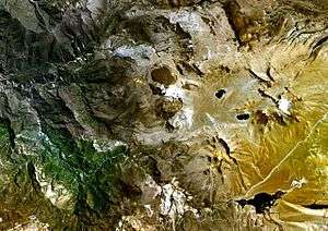 The Tixani lava dome complex (center) as seen from above with Chiñi Lakha and Jach'a Sirka southeast of it | |
| Highest point | |
| Elevation | 5,000 m (16,000 ft) [1] |
| Coordinates | 16°48′29″S 70°33′36″W |
| Geography | |
 Chiñi Lakha Peru | |
| Location | Peru, Moquegua Region |
| Parent range | Andes |
Chiñi Lakha is also the name of an intermittent stream which originates north of the mountain. It flows to the west.[1]
References
- escale.minedu.gob.pe - UGEL map of the Mariscal Nieto Province (Moquegua Region)
- Radio San Gabriel, "Instituto Radiofonico de Promoción Aymara" (IRPA) 1993, Republicado por Instituto de las Lenguas y Literaturas Andinas-Amazónicas (ILLLA-A) 2011, Transcripción del Vocabulario de la Lengua Aymara, P. Ludovico Bertonio 1612 (Spanish-Aymara-Aymara-Spanish dictionary)
This article is issued from Wikipedia. The text is licensed under Creative Commons - Attribution - Sharealike. Additional terms may apply for the media files.