Chapelgill Hill
Chapelgill Hill is a hill in the Culter Hills range, part of the Southern Uplands of Scotland. It is frequently climbed from the north-west, taking in the range's, and South Lanarkshire's, highest summit, Culter Fell. [4]
| Chapelgill Hill | |
|---|---|
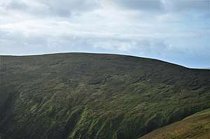 | |
| Highest point | |
| Elevation | 696 m (2,283 ft) [1] |
| Prominence | 104 m (341 ft) [2] |
| Listing | Hu,Tu,Sim,D,GT,DN,Y [3] |
| Geography | |
| Location | Scottish Borders, Scotland |
| Parent range | Culter Hills, Southern Uplands |
| OS grid | NT 06717 30368 |
| Topo map | OS Landranger 72 |
Subsidiary SMC Summits
| Summit | Height (m) | Listing[5] |
|---|---|---|
| Cardon Hill | 675 | Tu,Sim,DT,GT,DN[6] |
gollark: hd!histohist 271274710753476610 140516693242937345 <@319753218592866315> <@332271551481118732>
gollark: hd!histohist <@677461592178163712> -1
gollark: hd!histohist <@677461592178163712>
gollark: hd!histohist <@515035771359723520> <@509849474647064576>
gollark: hd!histohist <@!356107472269869058> <@509849474647064576>
References
- http://www.hill-bagging.co.uk/mountaindetails.php?qu=S&rf=1862
- http://www.hill-bagging.co.uk/mountaindetails.php?qu=S&rf=1862
- http://www.hills-database.co.uk/database_notes.html#classification
- "Chapelgill Hill". Database of British and Irish Hills. Hill Bagging. Retrieved 11 April 2020.
- http://www.hills-database.co.uk/database_notes.html#classification
- http://www.hill-bagging.co.uk/mountaindetails.php?qu=S&rf=1878
This article is issued from Wikipedia. The text is licensed under Creative Commons - Attribution - Sharealike. Additional terms may apply for the media files.