Champagne, Eure-et-Loir
Champagne is a former commune in the Eure-et-Loir department in northern France. Since January 2015, it is part of the commune Goussainville.
Champagne | |
|---|---|
Part of Goussainville | |
Location of Champagne 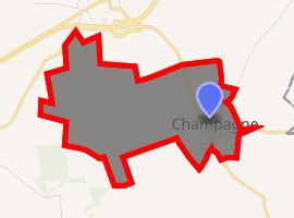
| |
 Champagne  Champagne | |
| Coordinates: 48°45′48″N 1°34′11″E | |
| Country | France |
| Region | Centre-Val de Loire |
| Department | Eure-et-Loir |
| Arrondissement | Dreux |
| Canton | Anet |
| Commune | Goussainville |
| Area 1 | 2.21 km2 (0.85 sq mi) |
| Population (2017)[1] | 328 |
| • Density | 150/km2 (380/sq mi) |
| Time zone | UTC+01:00 (CET) |
| • Summer (DST) | UTC+02:00 (CEST) |
| Postal code | 28410 |
| Elevation | 121–136 m (397–446 ft) (avg. 134 m or 440 ft) |
| 1 French Land Register data, which excludes lakes, ponds, glaciers > 1 km2 (0.386 sq mi or 247 acres) and river estuaries. | |
Population
| Year | Pop. | ±% |
|---|---|---|
| 1962 | 86 | — |
| 1968 | 73 | −15.1% |
| 1975 | 74 | +1.4% |
| 1982 | 85 | +14.9% |
| 1990 | 141 | +65.9% |
| 1999 | 179 | +27.0% |
| 2008 | 241 | +34.6% |
gollark: Er, can you rotate it so I can read it?
gollark: Not all of them support that, and probably not all devices do.
gollark: It is kind of annoying that because of weird radio spectrum licensing, WiFi and whatnot suffer bad interference issues because of being limited to a set of small overcrowded bands.
gollark: If it's actual physical airspace, can you *buy* exclusive rights to that? If so, that sounds bad.
gollark: Physical airspace or some of the radio spectrum?
References
| Wikimedia Commons has media related to Champagne (Eure-et-Loir). |
| Authority control |
|
|---|
This article is issued from Wikipedia. The text is licensed under Creative Commons - Attribution - Sharealike. Additional terms may apply for the media files.