Châtelais
Châtelais is a former commune in the Maine-et-Loire department of western France. On 15 December 2016, it was merged into the new commune Segré-en-Anjou Bleu.[2]
Châtelais | |
|---|---|
Part of Segré-en-Anjou Bleu | |
Location of Châtelais 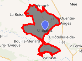
| |
 Châtelais  Châtelais | |
| Coordinates: 47°45′30″N 0°55′34″W | |
| Country | France |
| Region | Pays de la Loire |
| Department | Maine-et-Loire |
| Arrondissement | Segré |
| Canton | Segré |
| Commune | Segré-en-Anjou Bleu |
| Area 1 | 23.68 km2 (9.14 sq mi) |
| Population (2017)[1] | 657 |
| • Density | 28/km2 (72/sq mi) |
| Demonym(s) | Châtelaisien, Châtelaisienne |
| Time zone | UTC+01:00 (CET) |
| • Summer (DST) | UTC+02:00 (CEST) |
| Postal code | 49520 |
| Elevation | 26–102 m (85–335 ft) (avg. 90 m or 300 ft) |
| 1 French Land Register data, which excludes lakes, ponds, glaciers > 1 km2 (0.386 sq mi or 247 acres) and river estuaries. | |
Geography
The river Oudon flows through the middle of the commune and forms part of its northern border.
gollark: In theory I should be able to use reference counting or something to efficiently handle subexpressions, but no.
gollark: No, I WILL clone all.
gollark: What's a spanoform and why?
gollark: At some point. I'm on my phone.
gollark: Oh, my code isn't readable.
References
- Téléchargement du fichier d'ensemble des populations légales en 2017, INSEE
- Arrêté préfectoral 28 September 2016 (in French)
| Wikimedia Commons has media related to Châtelais. |
| Authority control |
|
|---|
This article is issued from Wikipedia. The text is licensed under Creative Commons - Attribution - Sharealike. Additional terms may apply for the media files.