Ceiba, Cidra, Puerto Rico
Ceiba is a barrio in the municipality of Cidra, Puerto Rico. Its population in 2010 was 3,850.[3][4][5]
Ceiba | |
|---|---|
Barrio | |
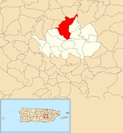 Location of Ceiba within the municipality of Cidra shown in red | |
 Ceiba Location of Puerto Rico | |
| Coordinates: 18°12′06″N 66°10′09″W[1] | |
| Commonwealth | |
| Municipality | |
| Area | |
| • Total | 4.44 sq mi (11.5 km2) |
| • Land | 4.44 sq mi (11.5 km2) |
| • Water | 0 sq mi (0 km2) |
| Elevation | 1,742 ft (531 m) |
| Population (2010) | |
| • Total | 3,850 |
| • Density | 867.1/sq mi (334.8/km2) |
| Source: 2010 Census | |
| Time zone | UTC−4 (AST) |
History
The United States took control of Puerto Rico from Spain in the aftermath of the Spanish-American War under the terms of the Treaty of Paris of 1898. In 1899, the United States conducted its first census of Puerto Rico finding that the population of Ceiba barrio and Río Abajo barrio was 1,100.[6]
Sectors
Barrios (which are like minor civil divisions)[7] in turn are further subdivided into smaller local populated place areas/units called sectores (sectors in English). The types of sectores may vary, from normally sector to urbanización to reparto to barriada to residencial, among others.[8][9][10]
The following sectors are in Ceiba barrio:[11]
Comunidad Naranjo, El Verde I, Finca Tommy Muñiz, Parcelas Hevia, Sector Agustín Cruz Ojeda, Sector Agustín Santos, Sector Carrasquillo (Sector González), Sector Delgado (El Llano), Sector Escalera, Sector Euclides Rivera, Sector Falcón, Sector Flores, Sector Garced, Sector Jacinto Hernández, Sector Joya Abajo, Sector La Frontera, Sector Las Paletas, Sector Meléndez, Sector Pablo Santos, Sector Peregín Santos, Sector Rafi Ruiz, Sector Ruiz, and Urbanización Estancias de Monte Río.
In Ceiba barrio is the Rodríguez Hevia urban zone and part of the Cidra urban zone.[5]
References
- "US Gazetteer 2019". US Census. US Government.
- U.S. Geological Survey Geographic Names Information System: Ceiba barrio
- Picó, Rafael; Buitrago de Santiago, Zayda; Berrios, Hector H. Nueva geografía de Puerto Rico: física, económica, y social, por Rafael Picó. Con la colaboración de Zayda Buitrago de Santiago y Héctor H. Berrios. San Juan Editorial Universitaria, Universidad de Puerto Rico,1969.
- Gwillim Law (20 May 2015). Administrative Subdivisions of Countries: A Comprehensive World Reference, 1900 through 1998. McFarland. p. 300. ISBN 978-1-4766-0447-3. Retrieved 25 December 2018.
- Puerto Rico:2010:population and housing unit counts.pdf (PDF). U.S. Dept. of Commerce, Economics and Statistics Administration, U.S. Census Bureau. 2010.
- Joseph Prentiss Sanger; Henry Gannett; Walter Francis Willcox (1900). Informe sobre el censo de Puerto Rico, 1899, United States. War Dept. Porto Rico Census Office (in Spanish). Imprenta del gobierno. p. 160.
- "US Census Barrio-Pueblo definition". factfinder.com. US Census. Archived from the original on 13 May 2017. Retrieved 5 January 2019.
- "Agencia: Oficina del Coordinador General para el Financiamiento Socioeconómico y la Autogestión (Proposed 2016 Budget)". Puerto Rico Budgets (in Spanish). Retrieved 28 June 2019.
- Rivera Quintero, Marcia (2014), El vuelo de la esperanza: Proyecto de las Comunidades Especiales Puerto Rico, 1997-2004 (first ed.), San Juan, Puerto Rico Fundación Sila M. Calderón, ISBN 978-0-9820806-1-0
- "Leyes del 2001". Lex Juris Puerto Rico (in Spanish). Retrieved 24 June 2020.
- "DESGLOSE DE SECTORES Y CENTROS DE VOTACIÓN PRECINTO ELECTORAL - CIDRA 076" (PDF). Comisión Estatal de Elecciones Puerto Rico (in Spanish). 20 July 2019. Retrieved 16 June 2020.