Cefn Carnedd
Cefn Carnedd is an Iron Age hillfort, about 1.5 miles (2 km) south-west of Caersws, in Powys, Wales. It is a scheduled monument.[1]
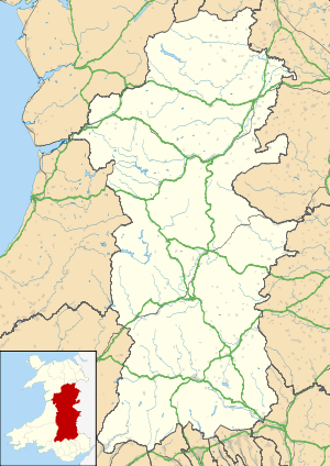
 Shown within Powys | |
| Location | Near Caersws, Wales grid reference SO 016 900 |
|---|---|
| Coordinates | 52°29′56″N 3°26′57″W |
| Type | Hillfort |
| Length | 437 metres (1,434 ft) |
| Width | 84 metres (276 ft) |
| Area | 6 hectares (15 acres) |
| History | |
| Periods | Iron Age |
It is on a hill overlooking the River Severn to the east, and Afon Cerist and Afon Trannon to the north; there is a river confluence to the north-east, between the fort and Caersws.
Description
The fort is about 437 metres (1,434 ft) by 84 metres (276 ft) orientated north-east to south-west, aligned with the shape of the hill; it encloses an area of about 6 hectares (15 acres). There are triple banks and ditches on the north-west side, and there are entrances in the north-east and south-west.[1][2]
In an early phase, there was a smaller fort of 1.6 hectares (4.0 acres) at the south-west end, traces of the north-east rampart of this being visible in aerial photographs. There is a straight bank and ditch across the interior, which was built at a late stage.[1][2]
History
It is thought that the fort may have been a stronghold of the Ordovices, and it is one of the locations suggested as the site of Caratacus's last battle in AD 51, when he was defeated by the Romans.[3]
References
- "Cefn Carnedd hillfort, near Caersws" Coflein. Retrieved 28 April 2020.
- Christopher Houlder. Wales: An Archaeological Guide. Faber and Faber, 1978. Page 96.
- "Cefn Carnedd: Possible battle site, near Caersws" Coflein. Retrieved 28 April 2020.