Cedars North Airpark
Cedars North Airpark (FAA LID: W58) is a privately owned, public use airport located one nautical mile (2 km) southeast of the central business district of Battle Ground, a city in Clark County, Washington, United States.[1][2]
Cedars North Airpark | |||||||||||
|---|---|---|---|---|---|---|---|---|---|---|---|
 | |||||||||||
| Summary | |||||||||||
| Airport type | Public use | ||||||||||
| Owner | Cedars Homeowners Association | ||||||||||
| Serves | Battle Ground, Washington | ||||||||||
| Elevation AMSL | 275 ft / 84 m | ||||||||||
| Coordinates | 45°45′52″N 122°30′54″W | ||||||||||
| Map | |||||||||||
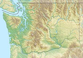 W58 Location of airport in Washington | |||||||||||
| Runways | |||||||||||
| |||||||||||
| Statistics (2012) | |||||||||||
| |||||||||||
Facilities and aircraft
Cedars North Airpark covers an area of 6 acres (2 ha) at an elevation of 275 feet (84 m) above mean sea level. It has one runway designated 8/26 with a turf surface measuring 1,960 by 50 feet (597 x 15 m).[1]
For the 12-month period ending July 30, 2012, the airport had 1,000 general aviation aircraft operations, an average of 83 per month. At that time, there were eight aircraft based at this airport, all single-engine.[1]
gollark: I'm not really explaining it right, but it's really annoying.
gollark: It seems like they're just interested in knowing magic physics words, or something, and not their actual meaning?
gollark: I tried to explain some basic statistics to them a while ago, and they mangled it horribly.
gollark: I'm not sure if they actually ever notice me insulting them, though.
gollark: They do manage to get less frustrated with nemysmerp1 or whatever it is than me.
References
- FAA Airport Master Record for W58 (Form 5010 PDF). Federal Aviation Administration. Effective November 15, 2012.
- "AirNav: W58 - Cedars North Airpark." AirNav. N.p., n.d. Web. 3 July 2010. <http://www.airnav.com/airport/W58>.
External links
- Cedars North (W58) at WSDOT Airport Directory
- Aerial image as of July 1990 from USGS The National Map
- Resources for this airport:
- FAA airport information for W58
- AirNav airport information for W58
- FlightAware airport information and live flight tracker
- SkyVector aeronautical chart for W58
This article is issued from Wikipedia. The text is licensed under Creative Commons - Attribution - Sharealike. Additional terms may apply for the media files.