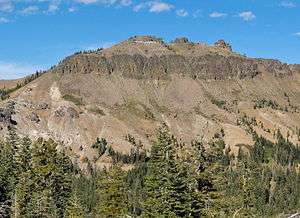
Castle Peak (California)
Castle Peak is a mountain in California's Sierra Nevada near I-80, Donner Pass, and the Nevada border. It is in the Tahoe National Forest[2] not far off the Pacific Crest Trail, and adjacent to Castle Pass. It was originally named Mount Stanford by the Whitney Survey of 1860–74.
| Castle Peak | |
|---|---|
 Castle Peak from Andesite Peak | |
| Highest point | |
| Elevation | 9,109 ft (2,776 m) NAVD 88[1] |
| Prominence | 1,343 ft (409 m) [2] |
| Listing | Sierra Peaks Section[3] |
| Coordinates | 39°21′56″N 120°20′57″W [1] |
| Geography | |
| Location | Nevada County, California, U.S. |
| Parent range | Sierra Nevada |
| Topo map | USGS Norden |
| Climbing | |
| Easiest route | Exposed scramble (class 3)[3] |
Castle Peak takes its name from its conical shape.[4]
See also
- Sierra Nevada subalpine zone — habitat and forest surrounding peak.
View of Castle Peak's summit, from terminus of the Castle Peak Summit Trail.
References
- "Castle Peak". NGS data sheet. U.S. National Geodetic Survey. Retrieved 2009-07-04.
- "Castle Peak, California". Peakbagger.com. Retrieved 2014-01-19.
- "Sierra Peaks Section List" (PDF). Angeles Chapter, Sierra Club. Retrieved 2009-07-04.
- Gannett, Henry (1905). The Origin of Certain Place Names in the United States. Government Printing Office. pp. 71.
External links
- "Castle Peak". Geographic Names Information System. United States Geological Survey. Retrieved 2009-12-18.
- "Castle Peak". SummitPost.org.
- "Castle Peak Trail". Trailspotting. Retrieved 2009-12-18.
- "Alpine Ski Tours - Lake Tahoe: North - Backcountry Ski Maps".
This article is issued from Wikipedia. The text is licensed under Creative Commons - Attribution - Sharealike. Additional terms may apply for the media files.
