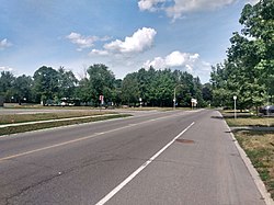
Carson Grove
Carson Grove is a neighbourhood in the east end of Ottawa, Ontario, Canada.[1] The neighbourhood spans the former Ottawa-Gloucester boundary, which still forms the boundary between Rideau-Rockcliffe Ward and Beacon Hill-Cyrville Ward.
Carson Grove | |
|---|---|
Neighbourhood | |
 Carson Grove Park | |
 Carson Grove | |
| Coordinates: 45.4358°N 75.6247°W | |
| Country | Canada |
| Province | Ontario |
| City | Ottawa |
| Government | |
| • MPs | Mona Fortier |
| • MPPs | Lucille Collard |
| • Councillors | Tim Tierney, Rawlson King |
| Area | |
| • Total | 1.595 km2 (0.616 sq mi) |
| Elevation | 75 m (246 ft) |
| Population (Canada 2016 Census) | |
| • Total | 2,918 |
| • Density | 1,800/km2 (4,700/sq mi) |
| Time zone | Eastern (EST) |
The neighbourhood was built in the early 1970s by the Campeau Corporation,[2] and was named for John Carson, an early settler in the region.[3] The neighbourhood was expanded in the mid-1990s with the building of Carson Village, which was developed by the Canada Mortgage and Housing Corporation. [4]
The neighbourhood is roughly bounded on the west by the Aviation Parkway, on the North by Collège La Cité, on the South by Ogilvie Road and on the east by Blair Road.[5] Some sources give Montreal Road as the northern boundary and Bathgate Road as the eastern border.[6]
According to the Canada 2016 Census, the neighbourhood had a population of 2,918.[7]
Surrounding neighbourhoods
References
- "Place names - Carson Grove".
- "Campeau". Ottawa Journal. October 23, 1971. Retrieved July 19, 2020.
- "Carson Village: Homes at the Heart of the City". Ottawa Citizen. March 26, 1994. Retrieved July 19, 2020.
- "Introducing Carson Village". Ottawa Citizen. October 2, 1993. Retrieved July 19, 2020.
- "Carson Grove gets bus service". Ottawa Journal. December 1, 1972. Retrieved July 19, 2020.
- http://www.gloucesterhistory.com/placenames.html
- Population calculated by combining Dissemination Areas 35060168, 35060165, 35060166 and 35060167