Cimetta
Cimetta is a mountain in the Lepontine Alps, it is located above Locarno and Lake Maggiore.
| Cimetta | |
|---|---|
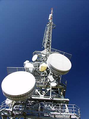 Radio relay tower on the top | |
| Highest point | |
| Elevation | 1,671 m (5,482 ft) |
| Prominence | 61 m (200 ft) [1] |
| Coordinates | 46°12′03″N 8°47′27.8″E |
| Geography | |
 Cimetta | |
| Parent range | Lepontine Alps |
| Climbing | |
| Easiest route | Aerial tramway |
The Locarno–Madonna del Sasso funicular links Locarno city centre with Orselina. From there a cable car connects to Cardada, from which a chair lift runs to the summit.
Climate
| Climate data for Cimetta (1981-2010) | |||||||||||||
|---|---|---|---|---|---|---|---|---|---|---|---|---|---|
| Month | Jan | Feb | Mar | Apr | May | Jun | Jul | Aug | Sep | Oct | Nov | Dec | Year |
| Average high °C (°F) | 1.0 (33.8) |
0.7 (33.3) |
3.2 (37.8) |
5.8 (42.4) |
10.5 (50.9) |
14.2 (57.6) |
16.6 (61.9) |
16.2 (61.2) |
12.4 (54.3) |
8.7 (47.7) |
4.0 (39.2) |
1.7 (35.1) |
7.9 (46.2) |
| Daily mean °C (°F) | −1.4 (29.5) |
−1.8 (28.8) |
0.4 (32.7) |
2.8 (37.0) |
7.3 (45.1) |
11.0 (51.8) |
13.5 (56.3) |
13.2 (55.8) |
9.7 (49.5) |
6.1 (43.0) |
1.7 (35.1) |
−0.7 (30.7) |
5.2 (41.4) |
| Average low °C (°F) | −3.7 (25.3) |
−4.2 (24.4) |
−2.0 (28.4) |
0.4 (32.7) |
4.8 (40.6) |
8.4 (47.1) |
10.9 (51.6) |
10.8 (51.4) |
7.6 (45.7) |
4.0 (39.2) |
−0.5 (31.1) |
−3.0 (26.6) |
2.8 (37.0) |
| Average precipitation mm (inches) | 48 (1.9) |
42 (1.7) |
68 (2.7) |
137 (5.4) |
194 (7.6) |
182 (7.2) |
159 (6.3) |
185 (7.3) |
209 (8.2) |
173 (6.8) |
122 (4.8) |
63 (2.5) |
1,583 (62.3) |
| Average snowfall cm (inches) | 0 (0) |
0 (0) |
0 (0) |
0 (0) |
0 (0) |
0 (0) |
0 (0) |
0 (0) |
0 (0) |
0 (0) |
0 (0) |
0 (0) |
0 (0) |
| Average precipitation days (≥ 1.0 mm) | 5.1 | 5.0 | 6.2 | 10.9 | 13.2 | 10.5 | 9.2 | 10.6 | 9.1 | 9.7 | 8.5 | 6.8 | 104.8 |
| Average snowy days (≥ 1.0 cm) | 0 | 0 | 0 | 0 | 0 | 0 | 0 | 0 | 0 | 0 | 0 | 0 | 0 |
| Average relative humidity (%) | 56 | 59 | 61 | 69 | 73 | 72 | 71 | 73 | 75 | 72 | 65 | 58 | 67 |
| Mean monthly sunshine hours | 161 | 164 | 200 | 176 | 180 | 217 | 249 | 228 | 178 | 157 | 138 | 143 | 2,191 |
| Source: MeteoSwiss [2] | |||||||||||||
gollark: Or to delete it and get a new one.
gollark: 2020s kids will exist in... 11 days.
gollark: Though if you throw in terrorist keywords and stuff, they might be nice and visit you *in person* to talk!
gollark: They might not respond, though.
gollark: You can chat with it *and* talk to the NSA and every other three-letter agency at the same time!
External links
References
- Swisstopo maps
- "Climate Norm Value Tables". Climate diagrams and normals from Swiss measuring stations. Federal Office of Meteorology and Climatology (MeteoSwiss). Archived from the original on 14 May 2013. Retrieved 23 January 2013. The weather station elevation is 1661 meters above sea level.
This article is issued from Wikipedia. The text is licensed under Creative Commons - Attribution - Sharealike. Additional terms may apply for the media files.