Capel Fell
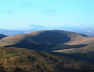
Capel Fell is a hill in the Ettrick Hills range, part of the Southern Uplands of Scotland. Close to the Southern Upland Way, routes of ascent frequently incorporate its track, however the track from Selcoth Fisheries to the west is also popular. It is frequently climbed with the neighbouring hills.[4]
| Capel Fell | |
|---|---|
 | |
| Highest point | |
| Elevation | 678 m (2,224 ft) [1] |
| Prominence | 159 m (522 ft) [2] |
| Listing | Ma,Hu,Tu,Sim,G,D,DN,Y [3] |
| Geography | |
| Location | Dumfries and Galloway, Scottish Borders, Scotland |
| Parent range | Ettrick Hills, Southern Uplands |
| OS grid | NT 16397 06906 |
| Topo map | OS Landranger 79 |
Subsidiary SMC Summits
| Summit | Height (m) | Listing[5] |
|---|---|---|
| Smidhope Hill | 644 | Tu,Sim,DT,GT,DN[6] |
| White Shank | 621.6 | DT,sSim[7] |
gollark: Good idea.
gollark: Impractical? Completely. Useful? No. Cool? Yes.
gollark: BSA: randomly add new BSA to the game.
gollark: And give it only to, I don't know, CB ~~brimstones~~ prizes.
gollark: BSA: transfer all dragons from one randomly selected scroll to another.
References
- https://www.hill-bagging.co.uk/mountaindetails.php?qu=S&rf=1875
- https://www.hill-bagging.co.uk/mountaindetails.php?qu=S&rf=1875
- http://www.hills-database.co.uk/database_notes.html#classification
- https://www.hill-bagging.co.uk/mountaindetails.php?qu=S&rf=1875
- http://www.hills-database.co.uk/database_notes.html#classification
- https://www.hill-bagging.co.uk/mountaindetails.php?qu=S&rf=1889
- https://www.hill-bagging.co.uk/mountaindetails.php?qu=S&rf=1905
This article is issued from Wikipedia. The text is licensed under Creative Commons - Attribution - Sharealike. Additional terms may apply for the media files.