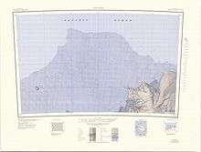
Cape Burks
Cape Burks is a prominent rock cape, the northwestern seaward extension of McDonald Heights, marking the east side of the entrance of Hull Bay on the coast of Marie Byrd Land. The cape was sighted and mapped from the USS Glacier, January 31, 1962, and was named for Lieutenant Commander Ernest Burks, U.S. Navy, senior helicopter pilot on the Glacier and the first person to set foot on the cape.

1:250,000 scale topographic map of McDonald Heights and Cape Burks.
Russkaya Station was established on Cape Burks by the Soviet Union in 1980.
Further reading
• Ute Christina Herzfeld, Atlas of Antarctica: Topographic Maps from Geostatistical Analysis of Satellite Radar Altimeter Data, P 194
• David G. Ainley, The Ad lie Penguin: Bellwether of Climate Change, P 78
• D.A. Tkacheva, E.V. Mikhalsky, N.M. Sushchevskaya, E.L. Kunakkuzin, S.G. Skublov, S.A. Sergeev, Mountain Age and Geochemistry of the Cape Burks Gabbroids (Russkaya Station Area, West Antarctica), Geokhimiya, 2018, No. 7, 2018, DOI: 10.1134/S001670291807011X
• E. V. Abakumov, Particle Size Distribution in Soils of West Antarctica, ISSN 1064-2293, Eurasian Soil Science, 2010, Vol. 43, No. 3, pp. 297–304, DOI: 10.1134/S1064229310030075, See P. 298
gollark: Randomly delayed *wrongly*, then.
gollark: Just assume government responses will randomly be delayed, too limited in scope, or cancelled after not being around for long! Although this is more <#689911928411521099>.
gollark: Places having the same name are confusing. We really should just use UUIDs.
gollark: As far as I know they're used. The "make it yourself" bit, though...
gollark: They wanted to make some hormones for hormone replacement therapy or something.
References

This article is issued from Wikipedia. The text is licensed under Creative Commons - Attribution - Sharealike. Additional terms may apply for the media files.