Cape Baranov
Cape Baranov (Russian: Мыс Баранова; Mys Baranova)[1] is a headland in Severnaya Zemlya, Russia.
| Cape Baranov | |
|---|---|
| Мыс Баранова | |
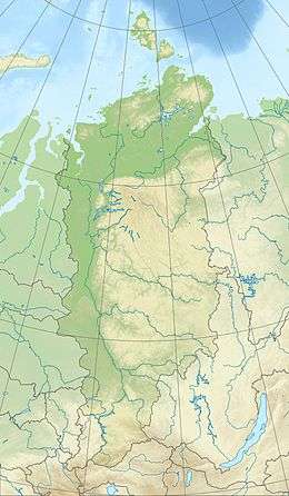 Location of Cape Baranov in Krasnoyarsk Krai | |
| Location | Bolshevik Island, Severnaya Zemlya, |
| Coordinates | 79°21′4″N 101°44′0″E |
| Offshore water bodies | Shokalsky Strait |
| Area | Russian Far North |
History
The Laptev Sea shore of present-day Severnaya Zemlya was discovered by Boris Vilkitsky in 1913 during the Arctic Ocean Hydrographic Expedition on behalf of the Russian Hydrographic Service, but he was unaware that there was a strait west of the cape between what is now Bolshevik Island and the islands further north, for the straits are frozen most of the year, forming a compact whole.[2][3]
This cape was named during the 1930–1932 expedition to the archipelago led by Georgy Ushakov and Nikolay Urvantsev after Soviet scientist Fedor Baranov (1886–1965).[4]
Located near Cape Baranov, roughly 15 km (9.3 mi) to the SSE of the cape,[5] the Prima Polar Station of the Arctic and Antarctic Research Institute closed down in 1996 and reopened in June 2013 as a private venture.[6] This is currently the only Arctic research facility operating in Severnaya Zemlya.[7][8]
Geography
Cape Baranov is located in the northern part of Bolshevik Island facing the Shokalsky Strait.[9] This headland stretches out northwards in an unglaciated lowland area west of the mouth of Mikoyan Bay.[1]
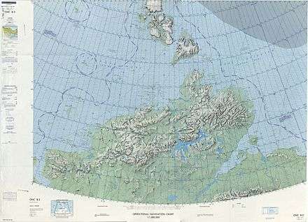 1975 map showing Severnaya Zemlya and the Taymyr Peninsula |
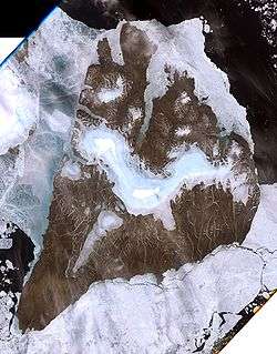 Landsat 7 image of Bolshevik Island |
References
- "Mys Baranova". Mapcarta. Retrieved 26 December 2016.
- Barr, William (1975). "Severnaya Zemlya: the last major discovery". Geographical Journal. 141 (1): 59–71. doi:10.2307/1796946.
- "Октябрьской Революции Остров" Great Soviet Encyclopedia
- Архипелаг Северная Земля — один из наиболее крупных районов оледенения на территории России
- Информационное сообщение об открытии «Ледовой базы «Мыс Баранова» для выполнения научных работ ААНИИ в 2013–2014 г.г.
- Фотогалерея: 2004 - "Полярное Кольцо" - Местонахождение: 17 мая, Северная Земля, о.Большевик, м.Баранова, п/ст Примах
- Bird Observations in Severnaya Zemlya, Siberia
- База Баранова, прием!
- GoogleEarth