Canal de l'Oise à l'Aisne
The Canal de l'Oise à l'Aisne is a summit level canal in the Hauts-de-France region (northern France), formerly Picardy. It connects the Canal latéral à l'Aisne at Abbécourt to the Canal latéral à l'Oise at Bourg-et-Comin.[1]
| Canal de l'Oise à l'Aisne | |
|---|---|
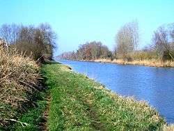 The Canal de l'Oise à l'Aisne at Guny (PK 11) | |
| Specifications | |
| Length | 48 km (30 mi) |
| Locks | 13 |
| History | |
| Date completed | 1890 |
| Geography | |
| Start point | Abbécourt |
| End point | Bourg-et-Comin |
| Beginning coordinates | 49.59195°N 3.19054°E |
| Ending coordinates | 49.38873°N 3.65561°E |
| Connects to | |
En route
- PK 0 Junction with Canal latéral à l'Aisne at Abbécourt
- PK 25.5 Pinon
- PK 35 Pargny-Filain
- Summit level reservoir, Bassin de Monampteuil
- PK 38-40.5 Braye-en-Laonnois tunnel (2365m) 49.45619°N 3.58789°E to 49.43816°N 3.60481°E
- PK 48 Junction with Canal latéral à l'Oise at Bourg-et-Comin
gollark: Instead of trying to make them work *everywhere*, and having massively overspecced batteries for most journeys.
gollark: I think a much better approach for self-driving cars would just be to have rentable self-driving short-range electric cars in big cities and stuff, which would use only whitelisted roads where you can make sure to apply necessary standardization and add whatever infrastructure is needed.
gollark: Lots of personal data, or at least stuff you could derive personal data *from*, too.
gollark: No, some of the projects giant companies do involve lots of data, it's not the same thing.
gollark: Also tracking everyone else, so I'm against that sort of thing.
See also
References
- Edwards-May, David (2010). Inland Waterways of France. St Ives, Cambs., UK: Imray. p. 192. ISBN 978-1-846230-14-1.
External links
- Canal de l'Oise à l'Aisne navigation guide; places, ports and moorings on the canal, by the author of Inland Waterways of France, Imray
- Navigation details for 80 French rivers and canals (French waterways website section)
This article is issued from Wikipedia. The text is licensed under Creative Commons - Attribution - Sharealike. Additional terms may apply for the media files.