Camp Branch (Swannanoa River tributary)
Camp Branch is a 1.54 mi (2.48 km) long 2nd order tributary to the Swannanoa River in Buncombe County, North Carolina.
| Camp Branch Tributary to Swannanoa River | |
|---|---|
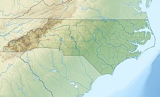
 Location of Camp Branch mouth  Camp Branch (Swannanoa River tributary) (the United States) | |
| Location | |
| Country | United States |
| State | North Carolina |
| County | Buncombe |
| Physical characteristics | |
| Source | base of Miami Mountain |
| • location | about 1 mile south of Black Mountain, North Carolina |
| • coordinates | 35°36′24″N 082°17′58″W[1] |
| • elevation | 2,880 ft (880 m)[2] |
| Mouth | Swannanoa River |
• location | about 0.25 miles south of Black Mountain, North Carolina |
• coordinates | 35°36′18″N 082°19′26″W[1] |
• elevation | 2,310 ft (700 m)[2] |
| Length | 1.54 mi (2.48 km)[3] |
| Basin size | 3.02 square miles (7.8 km2)[4] |
| Discharge | |
| • location | Swannanoa River |
| • average | 5.26 cu ft/s (0.149 m3/s) at mouth with Swannanoa River[4] |
| Basin features | |
| Progression | west-southwest |
| River system | French Broad River |
| Tributaries | |
| • left | unnamed tributaries |
| • right | unnamed tributaries |
| Bridges | Camp Branch Road (x3), Lakey Gap Road, Sellers Lane, Donne Drive, Chaucer Road, NC 9, Dogwood Lane, Blue Ridge Road |
Course
Camp Branch rises about 1 mile southeast of Black Mountain, North Carolina in Buncombe County at the base of Miami Mountain. Camp Branch then flows west-southwest to meet the Swannanoa River about 0.25 miles south of Black Mountain.[2]
Watershed
Camp Branch drains 3.02 square miles (7.8 km2) of area, receives about 50.3 in/year of precipitation, has a topographic wetness index of 238.99 and is about 81% forested.[4]
gollark: It seems to have a pretty clear explanation of what you need to do. Did you do that?
gollark: Is there more information on the error than that?
gollark: It does often, but lots of these AI things parallelize well and GPUs have way more raw computing power.
gollark: This is one of the more Cish modern languages around.
gollark: Better error messages are good. Writing more code for worse ones is actually not good.
References
- "GNIS Detail - Camp Branch". geonames.usgs.gov. US Geological Survey. Retrieved 13 October 2019.
- "Black Mountain Topo Map, Buncombe County NC (Black Mountain Area)". TopoZone. Locality, LLC. Retrieved 13 October 2019.
- "ArcGIS Web Application". epa.maps.arcgis.com. US EPA. Retrieved 13 October 2019.
- "Camp Branch Watershed Report". Waters Geoviewer. US EPA. Retrieved 13 October 2019.
This article is issued from Wikipedia. The text is licensed under Creative Commons - Attribution - Sharealike. Additional terms may apply for the media files.