Calabazas, San Sebastián, Puerto Rico
Calabazas is a barrio in the municipality of San Sebastián, Puerto Rico. Its population in 2010 was 2,768.[3][4][5]
Calabazas | |
|---|---|
Barrio | |
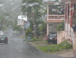 Houses and rain on a street in Calabazas | |
| Coordinates: 18°18′07″N 66°58′38″W[1] | |
| Commonwealth | |
| Municipality | |
| Area | |
| • Total | 5.69 sq mi (14.7 km2) |
| • Land | 5.69 sq mi (14.7 km2) |
| • Water | 0 sq mi (0 km2) |
| Elevation | 643 ft (196 m) |
| Population (2010) | |
| • Total | 2,768 |
| • Density | 486.5/sq mi (187.8/km2) |
| Source: 2010 Census | |
| Time zone | UTC−4 (AST) |
| Website | ssdelpepino |
History
The United States took control of Puerto Rico from Spain in the aftermath of the Spanish-American War under the terms of the Treaty of Paris of 1898 and conducted its first census of Puerto Rico finding that the population of Calabazas barrio was 746.[6]
Sectors
Barrios (which are like minor civil divisions)[7] in turn are further subdivided into smaller local populated place areas/units called sectores (sectors in English). The types of sectores may vary, from normally sector to urbanización to reparto to barriada to residencial, among others.[8][9][10]
The following sectors are in Calabazas barrio:[11]
Carretera 111, Carretera 4435, Residencial Jardines de Piedras Blancas, Sector Audeliz Torres, Sector Bartolo Cordero, Sector Cataño, Sector El Refugio, Sector Jandino Ruiz, Sector La Loma, Sector Lupe Mártir, Sector Mamey, Sector Orta, Sector Pablo Nieves (Los Pinos), Sector Quinto Ríos, Sector Rubén Hernández, Sector Toño Mestre, Urbanización Jardines Villy Ana, Urbanización Raholisa, Urbanización Venturini, and Urbanización Villas de Piedras Blancas.
Hurricane Maria
The road to the Calabazas bridge, which is over Culebrinas River suffered heavy damages with Hurricane Maria on September 20, 2017 and debris was piled up in and around the bridge.[12]
Gallery
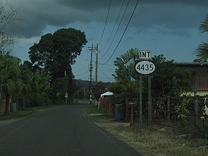 Highway 4435 in Calabazas
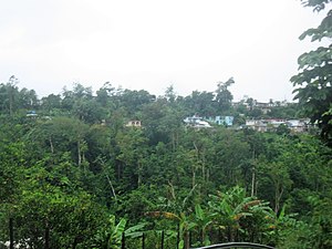 Calabazas
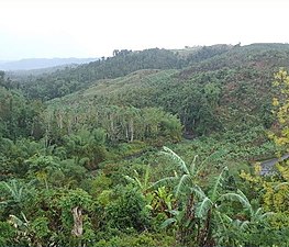 View from Calabazas towards Culebrinas River
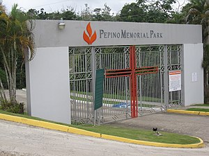 Pepino Memorial Park in Calabazas
See also
References
- "US Gazetteer 2019". US Census. US Government.
- U.S. Geological Survey Geographic Names Information System: Calabazas barrio
- Picó, Rafael; Buitrago de Santiago, Zayda; Berrios, Hector H. Nueva geografía de Puerto Rico: física, económica, y social, por Rafael Picó. Con la colaboración de Zayda Buitrago de Santiago y Héctor H. Berrios. San Juan Editorial Universitaria, Universidad de Puerto Rico,1969.
- Gwillim Law (20 May 2015). Administrative Subdivisions of Countries: A Comprehensive World Reference, 1900 through 1998. McFarland. p. 300. ISBN 978-1-4766-0447-3. Retrieved 25 December 2018.
- Puerto Rico:2010:population and housing unit counts.pdf (PDF). U.S. Dept. of Commerce, Economics and Statistics Administration, U.S. Census Bureau. 2010.
- Joseph Prentiss Sanger; Henry Gannett; Walter Francis Willcox (1900). Informe sobre el censo de Puerto Rico, 1899, United States. War Dept. Porto Rico Census Office (in Spanish). Imprenta del gobierno. p. 160.
- "US Census Barrio-Pueblo definition". factfinder.com. US Census. Archived from the original on 13 May 2017. Retrieved 5 January 2019.
- "Agencia: Oficina del Coordinador General para el Financiamiento Socioeconómico y la Autogestión (Proposed 2016 Budget)". Puerto Rico Budgets (in Spanish). Retrieved 28 June 2019.
- Rivera Quintero, Marcia (2014), El vuelo de la esperanza: Proyecto de las Comunidades Especiales Puerto Rico, 1997-2004 (first ed.), San Juan, Puerto Rico Fundación Sila M. Calderón, ISBN 978-0-9820806-1-0
- "Leyes del 2001". Lex Juris Puerto Rico (in Spanish). Retrieved 24 June 2020.
- "PRECINTO ELECTORAL SAN SEBASTIÁN 033" (PDF). Comisión Estatal de Elecciones (in Spanish). PR Government. 19 October 2018. Retrieved 19 June 2019.
- Bren, Sophi (25 September 2017). "Puente De Calabaza en San Sebastián Puerto Rico Septiembre 24, 2017 Huracán María" – via YouTube.