Cadwalader Inlet
Cadwalader Inlet is an ice-filled inlet about 22 nautical miles (40 km) long, indenting the northeast coast of Thurston Island between Evans Peninsula and Lofgren Peninsula. It was discovered on helicopter flights from the USS Burton Island and USS Glacier by personnel of the U.S. Navy Bellingshausen Sea Expedition in February 1960. It was named by the Advisory Committee on Antarctic Names for Captain John Cadwalader, U.S. Navy, chief of staff to U.S. Antarctic Projects Officer and representative of Task Unit Commander aboard the Burton Island in February 1960.[1]

Cadwalader Inlet
Location of Cadwalader Inlet in Antarctica
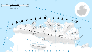
Map of Thurston Island.
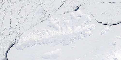
Satellite image of Thurston Island.
Maps
- Thurston Island – Jones Mountains. 1:500000 Antarctica Sketch Map. US Geological Survey, 1967.
- Antarctic Digital Database (ADD). Scale 1:250000 topographic map of Antarctica. Scientific Committee on Antarctic Research (SCAR). Since 1993, regularly upgraded and updated.
gollark: Do you agree that x + 5 = 5 + x regardless of x, even if x doesn't have a value yet?
gollark: It's the same equation.
gollark: It is NOT what my calculator says.
gollark: You *will get the wrong answer*.
gollark: That's a bad attitude and also false as you're not correct.
References
- "Cadwalader Inlet". Geographic Names Information System. United States Geological Survey. Retrieved 2011-10-14.
![]()
This article is issued from Wikipedia. The text is licensed under Creative Commons - Attribution - Sharealike. Additional terms may apply for the media files.