Cabbage Branch (Brown Creek tributary)
Cabbage Branch is a 3.59 mi (5.78 km) long 1st order tributary to Brown Creek in Anson County, North Carolina.
| Cabbage Branch Tributary to Brown Creek | |
|---|---|
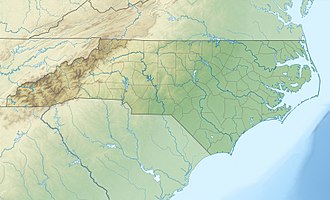
 Location of Cabbage Branch mouth  Cabbage Branch (Brown Creek tributary) (the United States) | |
| Location | |
| Country | United States |
| State | North Carolina |
| County | Anson |
| Physical characteristics | |
| Source | divide between Cabbage Branch and Buffalo Creek |
| • location | pond about 0.5 miles w of Ansonville, North Carolina |
| • coordinates | 35°06′22″N 080°07′53″W[1] |
| • elevation | 350 ft (110 m)[2] |
| Mouth | Brown Creek |
• location | about 3 miles south of Ansonville, North Carolina |
• coordinates | 35°03′56″N 080°06′50″W[1] |
• elevation | 213 ft (65 m)[2] |
| Length | 3.59 mi (5.78 km)[3] |
| Basin size | 2.08 square miles (5.4 km2)[4] |
| Discharge | |
| • location | Brown Creek |
| • average | 2.46 cu ft/s (0.070 m3/s) at mouth with Brown Creek[4] |
| Basin features | |
| Progression | south-southeast |
| River system | Pee Dee River |
| Tributaries | |
| • left | unnamed tributaries |
| • right | unnamed tributaries |
| Bridges | Ansonville-Polkton Road, Jacks Branch Road |
Course
Cabbage Branch rises in a pond about 0.5 miles west of Ansonville, North Carolina. Cabbage Branch then flows south-southeast to meet Brown Creek about 3 miles south of Ansonville, North Carolina.[2]
Watershed
Cabbage Branch drains 2.08 square miles (5.4 km2) of area, receives about 47.9 in/year of precipitation, has a topographic wetness index of 445.24 and is about 62% forested.[4]
gollark: Either that or I'm secretly just a bot.
gollark: I *can* talk, but with horrible noise, and I don't particularly want to now anyway.
gollark: I only have my laptop's internal microphone, which is, apparently, not very good.
gollark: Yep.
gollark: That's... everyone interested in voice chat, not just people in the channel.
References
- "GNIS Detail - Cabbage Branch". geonames.usgs.gov. US Geological Survey. Retrieved 21 October 2019.
- "Brown Creek Topo Map, Anson County NC (Ansonville Area)". TopoZone. Locality, LLC. Retrieved 21 October 2019.
- "Water Quality Ratings". www.nconemap.gov. State of North Carolina. Retrieved 21 October 2019.
- "Cabbage Branch Watershed Report". Waters Geoviewer. US EPA. Retrieved 21 October 2019.
This article is issued from Wikipedia. The text is licensed under Creative Commons - Attribution - Sharealike. Additional terms may apply for the media files.