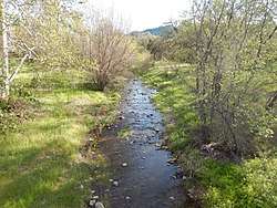
Cañada Garcia Creek
Cañada Garcia Creek is a perennial stream in southwest Santa Clara County, California, United States.[4] The headwaters rise on the southern flank of Portezuelo Gap near Manzanita Ridge in the eastern foothills of the Santa Cruz Mountains. From there, the creek flows southeastward, eventually merging with Llagas Creek.
| Cañada Garcia Creek | |
|---|---|
 Cañada Garcia Creek near Old Oak Glen Avenue | |
| Location | |
| Country | United States |
| State | California |
| Region | Santa Clara County |
| City | Morgan Hill, California |
| Physical characteristics | |
| Source | On the southern flank of Portezuelo Gap near Manzanita Ridge in the eastern foothills of the Santa Cruz Mountains[1][2][3] |
| • coordinates | 37°08′12″N 121°45′53″W[1] |
| • elevation | 1,080 ft (330 m) |
| Mouth | Confluence with Llagas Creek |
• coordinates | 37°07′27″N 121°44′00″W[1] |
• elevation | 530 ft (160 m) |
| Length | 2.5 mi (4.0 km) |
History
In Spanish, the word "cañada" means "ravine". The valley around the ravine and creek was once part of the larger Pueblo Tract Nº 3 and Rancho Las Uvas lands granted in the mid-19th century.[5]
Ecology
Cañada Garcia is one of several serpentine valley habitats identified as helping to sustain Bay checkerspot butterfly populations.[6]
gollark: <:boron:674876365367017492>eans
gollark: Histograms are just... why. Did they think "we must invent the most confusing and irritating possible way to represent data" or something?
gollark: I quite like maths. Except circle theorems and histograms.
gollark: They get around the fact that common calculators can do a not insignificant amount of the maths-exam stuff automatically by having a non-calculator paper for further maths, requiring working, and having more complex multi-step questions.
gollark: Maths, physics, chemistry, biology (very occasionally, it's not that mathy).
See also
References
- "Cañada Garcia Creek". Geographic Names Information System. United States Geological Survey.
- "Portezuelo Gap". Geographic Names Information System. United States Geological Survey.
- "Manzanita Ridge". Geographic Names Information System. United States Geological Survey.
- Santa Clara Valley Water District. "Uvas and Llagas Creeks Watershed". Archived from the original on 2017-08-09. Retrieved 2017-08-13.
- Library of Congress. "1889 Map of the County of Santa Clara, California". San Jose, CA : Herrmann Bros. Retrieved 2017-08-13.
- Santa Clara County (August 2012). "Santa Clara Valley Habitat Plan". Retrieved 2017-08-13.
External links
- "Llagas Creek Watershed Tour". Retrieved 2017-08-11.
This article is issued from Wikipedia. The text is licensed under Creative Commons - Attribution - Sharealike. Additional terms may apply for the media files.