Burrow (Shropshire)
Burrow is a hill in Shropshire with an Iron Age hill fort at the summit known as Burrow Camp. The nearest villages are Hopesay and Aston-on-Clun. It includes a large number of hut platforms, and two natural springs.[2]
| Burrow | |
|---|---|
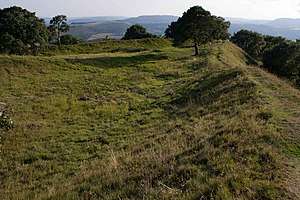 South-west corner of the hill fort | |
| Highest point | |
| Elevation | 358 m (1,175 ft) [1] |
| Prominence | c. 189 m [1] |
| Parent peak | Pegwn Mawr |
| Listing | Marilyn |
| Geography | |
| Location | Shropshire, England |
| Parent range | Shropshire Hills |
| OS grid | SO381830 |
| Topo map | OS Landranger 137 [1] |
At 15:45 on 13 September 1943 a Vickers Wellington crashed on the hill. The flight was part of a cross-country and practice bombing exercise from RAF Chipping Warden, Northamptonshire. The crew encountered a severe thunderstorm above south Shropshire and was seen to be struck by lightning while flying over Lydbury North causing the plane to catch fire and lose height before disintegrating on the hilltop killing all eight crew members.[3]
References
- Alan Dawson (1997). "Region 38 Welsh Borders". The Hewitts and Marilyns of England. TACit Press. ISBN 0-9522680-7-8. Archived from the original on 2011-08-09. Retrieved 2011-07-27.
- John Newman & Nikolaus Pevsner (2006). "Hopesay". Shropshire. Pevsner Architectural Guides: The Buildings of England (2nd ed.). Yale University Press. pp. 306–307. ISBN 978-0-300-12083-7.
- Thomas Thorne (2013). Pancakes and Prangs: Twentieth-century Military Aircraft Accidents in Shropshire. Bridge Books. pp. 166–167. ISBN 978-1-84494-087-5.
This article is issued from Wikipedia. The text is licensed under Creative Commons - Attribution - Sharealike. Additional terms may apply for the media files.