Brush Creek (Reedy Fork tributary)
Brush Creek is a 8.15 mi (13.12 km) long 2nd order tributary to Reedy Fork in Guilford County, North Carolina.
| Brush Creek Tributary to Reedy Fork | |
|---|---|
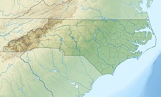
 Location of Brush Creek mouth  Brush Creek (Reedy Fork tributary) (the United States) | |
| Location | |
| Country | United States |
| State | North Carolina |
| County | Guilford |
| Physical characteristics | |
| Source | divide between Brush Creek and Deep River |
| • location | about 0.5 miles northwest of Piedmont Triad International Airport |
| • coordinates | 36°07′17″N 079°57′46″W[1] |
| • elevation | 910 ft (280 m)[2] |
| Mouth | Reedy Fork |
• location | Lake Brandt |
• coordinates | 36°10′18″N 079°52′38″W[1] |
• elevation | 741 ft (226 m)[2] |
| Length | 8.15 mi (13.12 km)[3] |
| Basin size | 11.74 square miles (30.4 km2)[4] |
| Discharge | |
| • location | Reedy Fork |
| • average | 12.82 cu ft/s (0.363 m3/s) at mouth with Reedy Fork[4] |
| Basin features | |
| Progression | northeast |
| River system | Haw River |
| Tributaries | |
| • left | unnamed tributaries |
| • right | unnamed tributaries |
| Waterbodies | Lake Higgins Lake Brandt |
| Bridges | NC 68, Cornerstone Drive, Ted Johnson Parkway, I-73, Muirfield Drive, Fleming Road, Brass Eagle Loop, Lewiston Road, Carlson Dairy Road, US 220 |
Course
Brush Creek rises on the Deep River divide about 0.5 miles northwest of Piedmont Triad International Airport in Guilford County, North Carolina. Brush Creek then flows northeast to meet Reedy Fork in Lake Brandt.[2]
Watershed
Brush Creek drains 11.74 square miles (30.4 km2) of area, receives about 44.8 in/year of precipitation, has a topographic wetness index of 419.83 and is about 26% forested.[4]
gollark: I mean, to some extent, but they *consistently* lied about all their data so who knows, and covering up is a monorically stupid initial response.
gollark: Unless they had another one in the last few months.
gollark: COVID-19?
gollark: Yes, they really managed the pandemic well in China by trying to ignore it/cover it up and hoping it would go away.
gollark: I like authoritarian governments, but only if they magically make everything work better with no problems and never cause problems for me or anyone else I know.
References
- "GNIS Detail - Brush Creek". geonames.usgs.gov. US Geological Survey. Retrieved 10 October 2019.
- "Brush Creek Topo Map, Guilford County NC (Summerfield Area)". TopoZone. Locality, LLC. Retrieved 10 October 2019.
- "ArcGIS Web Application". epa.maps.arcgis.com. US EPA. Retrieved 10 October 2019.
- "Brush Creek Watershed Report". Waters Geoviewer. US EPA. Retrieved 10 October 2019.
This article is issued from Wikipedia. The text is licensed under Creative Commons - Attribution - Sharealike. Additional terms may apply for the media files.