Bridgetown, Devon
Bridgetown occupies the left bank of the Dart in the town of Totnes, Devon, England.[1][2]
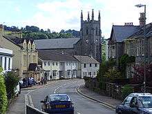
Bridgetown, looking west towards Totnes.
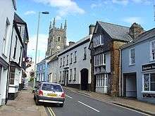
Looking east towards Paignton.
It resulted from the first bridge being built across the river for the town. The river is in a valley, with Bridgetown on the south eastern slopes opposite Totnes.
It has a tall C of E church with tower in the parish of Totnes with Bridgetown,[3] a village hall, two large grassy play areas, a dental surgery, a farm, a butcher, two small corner shops, a Chinese takeaway, one public house, which includes its own brewery, Longmarsh — a riverside walk also used for military training, a rowing club, a caravan park and a veterinary clinic.
References
- Ordnance Survey: Landranger map sheet 202 Torbay & South Dartmoor (Totnes & Salcombe) (Map). Ordnance Survey. 2009. ISBN 9780319232880.
- "Ordnance Survey: 1:50,000 Scale Gazetteer" (csv (download)). www.ordnancesurvey.co.uk. Ordnance Survey. 1 January 2016. Retrieved 30 January 2016.
- https://www.achurchnearyou.com/search/?lat=50.430&lon=-3.680
External links
![]()
This article is issued from Wikipedia. The text is licensed under Creative Commons - Attribution - Sharealike. Additional terms may apply for the media files.