Booneville Municipal Airport
Booneville Municipal Airport (FAA LID: 4M2) is a city-owned, public-use airport located three nautical miles (6 km) east of the central business district of Booneville, a city in Logan County, Arkansas, United States.[1]
Booneville Municipal Airport | |||||||||||
|---|---|---|---|---|---|---|---|---|---|---|---|
 | |||||||||||
| Summary | |||||||||||
| Airport type | Public | ||||||||||
| Owner | City of Booneville | ||||||||||
| Serves | Booneville, Arkansas | ||||||||||
| Elevation AMSL | 465 ft / 142 m | ||||||||||
| Coordinates | 35°08′58″N 093°51′44″W | ||||||||||
| Website | BoonevilleAirport.com | ||||||||||
| Map | |||||||||||
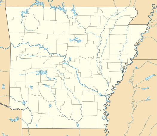 4M2 Location of airport in Arkansas | |||||||||||
| Runways | |||||||||||
| |||||||||||
| Statistics (2010) | |||||||||||
| |||||||||||
Facilities and aircraft
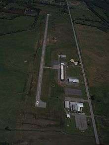
Booneville Municipal Airport covers an area of 200 acres (81 ha) at an elevation of 465 feet (142 m) above mean sea level. It has one runway designated 9/27 with an asphalt surface measuring 3,254 by 50 feet (992 x 15 m).[1]
For the 12-month period ending December 31, 2010, the airport had 5,000 general aviation aircraft operations, an average of 13 per day. At that time there were 17 aircraft based at this airport: 94% single-engine and 6% ultralight.[1]
gollark: Yes.
gollark: It prints 1 and 2 in separate threads.
gollark: Otherwise it just returns a new macro with 2 added to all the outputs.
gollark: `m + 2` with m an arbitrary macro adds 2 to the source of the macro and compiles it. If this is valid it is done. Otherwise it increments all the codepoints by 2 and compiles. If this is valid it is done.
gollark: The Macron compiler runtime compiler will solve it.
References
- FAA Airport Master Record for 4M2 (Form 5010 PDF). Federal Aviation Administration. Effective November 15, 2012.
External links
- Booneville Municipal Airport
- Booneville Municipal (4M2) at Arkansas Department of Aeronautics
- Aerial image as of February 2001 from USGS The National Map
- Airfield photos from U.S. Civil Air Patrol at the Wayback Machine (archived September 23, 2006)
- Resources for this airport:
- FAA airport information for 4M2
- AirNav airport information for 4M2
- FlightAware airport information and live flight tracker
- SkyVector aeronautical chart for 4M2
This article is issued from Wikipedia. The text is licensed under Creative Commons - Attribution - Sharealike. Additional terms may apply for the media files.