Boone County Airport (Arkansas)
Boone County Airport (IATA: HRO, ICAO: KHRO, FAA LID: HRO) is a county-owned public-use airport in Boone County, Arkansas, United States.[1] Also known as Boone County Regional Airport,[2] it is located three nautical miles (6 km) northwest of the central business district of Harrison, Arkansas.[1] The airport serves the surrounding areas including Branson, Missouri. It is mostly used for general aviation but is also served by one commercial airline, a service which is subsidized by the federal government's Essential Air Service program at a cost of $2,251,207 (per year).[3]
Boone County Airport Boone County Regional Airport | |||||||||||
|---|---|---|---|---|---|---|---|---|---|---|---|
 Aerial view of airport, 2009 | |||||||||||
| Summary | |||||||||||
| Airport type | Public | ||||||||||
| Owner | Boone County | ||||||||||
| Serves | Harrison, Arkansas | ||||||||||
| Elevation AMSL | 1,365 ft / 416 m | ||||||||||
| Coordinates | 36°15′41″N 093°09′17″W | ||||||||||
| Website | BooneCountyAirport.com | ||||||||||
| Map | |||||||||||
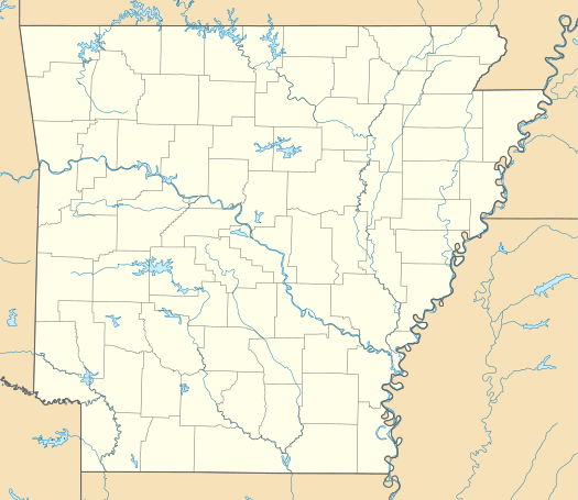 HRO Location of airport in Arkansas  HRO HRO (the United States) | |||||||||||
| Runways | |||||||||||
| |||||||||||
| Statistics | |||||||||||
| |||||||||||
This airport is included in the National Plan of Integrated Airport Systems for 2017–2021, which categorized it as a national/regional airport (the commercial service category requires at least 2,500 enplanements per year).[4]
Facilities and aircraft
Boone County Airport covers an area of 425 acres (172 ha) at an elevation of 1,365 feet (416 m) above mean sea level. It has one runway designated 18/36 with an asphalt surface measuring 6,161 by 150 feet (1,878 x 46 m).[1]
For the 12-month period ending July 31, 2016, the airport had 10,750 aircraft operations, an average of 29 per day: 69% general aviation, 20% commercial service, 11% air taxi, and less than 1% military. In October 2018, there were 44 aircraft based at this airport: 37 single-engine, 5 multi-engine, and 2 jet.[1]
Airline and non-stop destinations
| Airlines | Destinations |
|---|---|
| Southern Airways Express | Dallas/Fort Worth, Memphis |
| Destinations map |
|---|
Destinations from Boone County Airport |

See also
- M. Graham Clark Downtown Airport
- Branson Airport
- Northwest Arkansas Regional Airport
References
- FAA Airport Master Record for HRO (Form 5010 PDF). Federal Aviation Administration. effective October 11, 2018.
- Boone County Regional Airport, official website
- "Essential Air Service Reports". U.S. Department of Transportation. Retrieved June 7, 2014.
- "2011–2015 NPIAS Report, Appendix A" (PDF). National Plan of Integrated Airport Systems. Federal Aviation Administration. October 4, 2010. Archived from the original (PDF, 2.03 MB) on 2012-09-27.
Other sources
- Essential Air Service documents (Docket OST-1997-2935) from the U.S. Department of Transportation:
- Order 2005-1-14: selecting Air Midwest, Inc., to provide essential air service at El Dorado/Camden, Jonesboro, Harrison and Hot Springs, Arkansas, at a subsidy rate of $4,155,550 annually for a two-year rate term.
- Order 2007-1-7: selecting Air Midwest, Inc. to provide essential air service at El Dorado/Camden, Jonesboro, Harrison and Hot Springs, Arkansas, at a subsidy rate of $4,296,348 annually for the two-year rate term beginning April 1, 2007.
- Order 2009-6-25: tentatively selecting Alaska Juneau Aeronautics, Inc. d/b/a SeaPort Airlines (SeaPort) to provide subsidized essential air service (EAS) at El Dorado/Camden, Harrison, Hot Springs, and Jonesboro, Arkansas, for two years.
- Order 2009-7-8: making final the tentative selection of Alaska Juneau Aeronautics, Inc. d/b/a SeaPort Airlines, to provide essential air service at El Dorado/Camden, Harrison, Hot Springs, and Jonesboro, Arkansas.
External links
- Boone County Regional Airport, official website
- Boone County Airport (HRO) at the Arkansas Department of Aeronautics
- Aerial image as of 28 February 2001 from USGS The National Map
- FAA Terminal Procedures for HRO, effective August 13, 2020
- Resources for this airport:
- FAA airport information for HRO
- AirNav airport information for KHRO
- ASN accident history for HRO
- FlightAware airport information and live flight tracker
- NOAA/NWS weather observations: current, past three days
- SkyVector aeronautical chart, Terminal Procedures