Black Butte (Madison County, Montana)
Black Butte, el. 10,547 feet (3,215 m) is the highest peak in the Gravelly Range in Madison County, Montana. The eastern base of the peak is less than 1 mile (1.6 km) from the Beaverhead-Deerlodge National Forest road #290 (Gravelly Range Road).
| Black Butte | |
|---|---|
| Pyroxene Butte | |
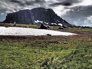 Southeast face Black Butte | |
| Highest point | |
| Elevation | 10,547 ft (3,215 m) [1] |
| Prominence | 3,182 ft (970 m) [1] |
| Coordinates | 44°54′16″N 111°51′18″W[2] |
| Geography | |
 Black Butte | |
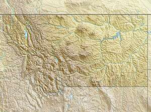
| Parent range | Gravelly Range |
| Topo map | Big Horn Mountain |
See also
Notes
- "Black Butte, Montana". Peakbagger.com. Retrieved May 10, 2018.
- "Black Butte". Geographic Names Information System. United States Geological Survey.
This article is issued from Wikipedia. The text is licensed under Creative Commons - Attribution - Sharealike. Additional terms may apply for the media files.