Bléone
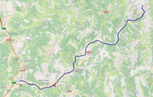
The Bléone (French: la Bléone) is a 67.5-kilometre (41.9 mi) long river in the Alpes-de-Haute-Provence département, southeastern France. Its source is several small streams converging near the refuge de l'Estrop, a mountain shelter in Prads-Haute-Bléone. It flows generally southwest. It is a left tributary of the Durance into which it flows between L'Escale and Les Mées.
| Bléone | |
|---|---|
 The Bléone at Malijai | |
 | |
| Location | |
| Country | France |
| Physical characteristics | |
| Source | |
| • location | Prads-Haute-Bléone |
| • coordinates | 44°16′19″N 06°41′31″E |
| • elevation | 1,980 m (6,500 ft) |
| Mouth | |
• location | Durance |
• coordinates | 44°03′09″N 05°59′48″E |
• elevation | 400 m (1,300 ft) |
| Length | 67.5 km (41.9 mi) |
| Basin size | 906 km2 (350 sq mi) |
| Basin features | |
| Progression | Durance→ Rhône→ Mediterranean Sea |
Communes along its course
This list is ordered from source to mouth: Prads-Haute-Bléone, La Javie, Le Brusquet, Marcoux, Digne-les-Bains, Aiglun, Mallemoisson, Le Chaffaut-Saint-Jurson, Mirabeau, Malijai, L'Escale, Les Mées,
Notes
- This article is based on the equivalent article from the French Wikipedia, consulted on 13 April 2009.
gollark: https://discord.gg/MXfJJsV
gollark: We made a discord server for the schoolgoing public to discuss policy.
gollark: I'm standing for ~~group of figureheads~~ school council.
gollark: Better fernmoji but keep the old ones.
gollark: Better fernmoji.
This article is issued from Wikipedia. The text is licensed under Creative Commons - Attribution - Sharealike. Additional terms may apply for the media files.