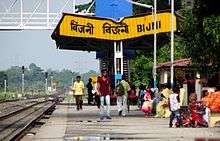
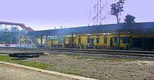
Bijni
Bijni is a town in Chirang district under the jurisdiction of Bodoland Territorial Council which controls the Bodoland Territorial Area Districts in the state of Assam.
Bijni | |
|---|---|
town | |
 Bijni Location in Assam, India  Bijni Bijni (India) | |
| Coordinates: 26.5167°N 90.6667°E | |
| Country | |
| State | Assam |
| District | Chirang |
| Founded by | Lakheshwar Brahma |
| Government | |
| • Body | Bijni Town Committee |
| Elevation | 53 m (174 ft) |
| Population (2011) | |
| • Total | 13,257 |
| Languages | |
| • Official | Assamese |
| Time zone | UTC+5:30 (IST) |
| ISO 3166 code | IN-AS |
| Vehicle registration | AS |
| Website | http://www.bijni.in |
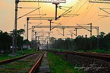
Geography
Bijni is located on the northern bank of Brahmaputra river, at 26°31′N 90°40′E.[1] It has an average elevation of 53 metres (173 feet).[1]
Demographics
As of 2011 India census,[2] Bijni had a population of 13257. Males constitute 50.4% of the population and females 49.6%. Bijni has an average literacy rate of 89.37%, higher than the national average of 74.04%; with male literacy of 93.65% and female literacy of 85.01%. 9% of the population is under 6 years of age. Bijni is surrounded by village Kawatika, Doturi, Batabari, Bhetagaon, Chhatianguri, Lechiagaon, Amguri, Puran Bijni, Gerukabari, Saktola, Goraimari and Baghmara, Majrabari, bijni panbari road(deukura par).
Koch Dynasty
The Bijni branch of the Koch dynasty controlled its feudatory from the present-day Bijni town from 1671 till 1864 when it was attacked by Jhawlia Mech, a chieftain from Bhutan which used to be part of Kamrup Kingdom. This resulted in the capital moving to Dumuria. In 1897, an earthquake destroyed many royal palaces and other structures and the capital moved again. The control of Bijni by the Koch Dynasty ended in 1956, as the Indian Government took direct control of the entire region.
Politics
Bijni is part of Kokrajhar (Lok Sabha constituency).[3]
References
- "Falling Rain Genomics, Inc - Bijni". fallingrain.com.
- "Census of India 2001: Data from the 2001 Census, including cities, villages and towns (Provisional)". Census Commission of India. Archived from the original on 16 June 2004. Retrieved 1 November 2008.
- "List of Parliamentary & Assembly Constituencies" (PDF). Assam. Election Commission of India. Archived from the original (PDF) on 4 May 2006. Retrieved 5 October 2008.