Bhuntar
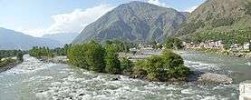
Bhuntar is a town and a nagar panchayat in Kullu district in the state of Himachal Pradesh, India. Bhuntar Airport also known as Kullu airport, serves the town along with Kullu and Manali, is located here.[1].At the confluence of the Parvati River with the River Beas, the Parvati Valley runs eastwards, through a steep-sided valley towards Kasol and Manikaran.
Bhuntar | |
|---|---|
city | |
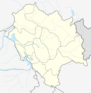 Bhuntar Location in Himachal Pradesh, India  Bhuntar Bhuntar (India) | |
| Coordinates: 31.86°N 77.15°E | |
| Country | |
| State | Himachal Pradesh |
| District | Kullu |
| Population (2011) | |
| • Total | 4,475 |
| Languages | |
| • Official | Hindi |
| Time zone | UTC+5:30 (IST) |
| Vehicle registration | HP |
Climate
| Climate data for Bhuntar (Kullu–Manali Airport) 1981–2010, extremes 1960–2011) | |||||||||||||
|---|---|---|---|---|---|---|---|---|---|---|---|---|---|
| Month | Jan | Feb | Mar | Apr | May | Jun | Jul | Aug | Sep | Oct | Nov | Dec | Year |
| Record high °C (°F) | 25.4 (77.7) |
27.1 (80.8) |
32.3 (90.1) |
37.3 (99.1) |
40.0 (104.0) |
39.4 (102.9) |
37.4 (99.3) |
37.8 (100.0) |
35.2 (95.4) |
33.2 (91.8) |
29.4 (84.9) |
27.0 (80.6) |
40.0 (104.0) |
| Average high °C (°F) | 16.0 (60.8) |
18.0 (64.4) |
22.1 (71.8) |
27.2 (81.0) |
31.0 (87.8) |
33.1 (91.6) |
31.7 (89.1) |
31.0 (87.8) |
30.1 (86.2) |
27.8 (82.0) |
23.0 (73.4) |
17.8 (64.0) |
25.7 (78.3) |
| Average low °C (°F) | 1.6 (34.9) |
3.7 (38.7) |
6.7 (44.1) |
9.7 (49.5) |
12.9 (55.2) |
16.8 (62.2) |
19.9 (67.8) |
19.9 (67.8) |
16.6 (61.9) |
9.8 (49.6) |
4.6 (40.3) |
1.7 (35.1) |
10.3 (50.5) |
| Record low °C (°F) | −4.7 (23.5) |
−4.5 (23.9) |
0.2 (32.4) |
3.5 (38.3) |
4.6 (40.3) |
6.1 (43.0) |
11.1 (52.0) |
10.9 (51.6) |
7.8 (46.0) |
3.5 (38.3) |
−1.5 (29.3) |
−5.2 (22.6) |
−5.2 (22.6) |
| Average rainfall mm (inches) | 77.0 (3.03) |
110.7 (4.36) |
129.9 (5.11) |
78.1 (3.07) |
72.8 (2.87) |
54.0 (2.13) |
133.6 (5.26) |
113.3 (4.46) |
75.8 (2.98) |
32.8 (1.29) |
21.8 (0.86) |
41.9 (1.65) |
941.8 (37.08) |
| Average rainy days | 4.6 | 6.6 | 8.1 | 6.1 | 6.4 | 4.7 | 8.5 | 8.8 | 5.3 | 1.8 | 1.6 | 2.5 | 65.1 |
| Average relative humidity (%) (at 17:30 IST) | 51 | 49 | 45 | 40 | 39 | 43 | 58 | 61 | 56 | 44 | 44 | 50 | 48 |
| Source: India Meteorological Department[2][3] | |||||||||||||
Demographics
As of 2005 India census,[4] Bhuntar had a population of 5260. Males constitute 55% of the population and females 45%. Bhuntar has an average literacy rate of 80%, higher than the national average of 59.5%; with male literacy of 84% and female literacy of 76%. 11% of the population is under 6 years of age. Bhuntar has an Airport which connects big cities like Delhi via air. Bhuntar is center for accessing areas such as Kasol, Manikaran and Manali.
References
- "Kullu". Airport Authority of India. Archived from the original on 23 March 2014. Retrieved 24 March 2014.
- "Station: Bhuntar (A) Climatological Table 1981–2010" (PDF). Climatological Normals 1981–2010. India Meteorological Department. January 2015. pp. 145–146. Archived from the original (PDF) on 5 February 2020. Retrieved 15 February 2020.
- "Extremes of Temperature & Rainfall for Indian Stations (Up to 2012)" (PDF). India Meteorological Department. December 2016. p. M67. Archived from the original (PDF) on 5 February 2020. Retrieved 15 February 2020.
- "Census of India 2001: Data from the 2001 Census, including cities, villages and towns (Provisional)". Census Commission of India. Archived from the original on 16 June 2004. Retrieved 1 November 2008.