Bhota
Bhota is a town and a nagar panchayat in Hamirpur district in the state of Himachal Pradesh, India. It is also a village situated in District Hamirpur, Himachal Pradesh, its geographical coordinates are 32° 46' 0" North, 74° 1' 0" East and its original name (with diacritics) is Bhota.
Bhota | |
|---|---|
city | |
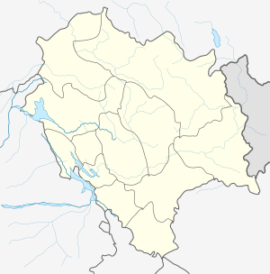
 Bhota Location in Himachal Pradesh, India  Bhota Bhota (India) | |
| Coordinates: 31.6087478°N 76.5672827°E | |
| Country | |
| State | Himachal Pradesh |
| District | Hamirpur |
| Population (2011) | |
| • Total | 1,453 |
| Languages | |
| • Official | Hindi |
| Time zone | UTC+5:30 (IST) |
Demographics
As of 2001 India census,[1] Bhota had a population of 1472. Males constitute 52% of the population and females 48%. Bhota has an average literacy rate of 89%, higher than the national average of 59.5%; with male literacy of 83% and female literacy of 76%. 11% of the population is under 6 years of age.
Area profile of Bhota Town
Number of Households - 337
Average Household Size (per Household) - 4.0
Population-Total - 1,472
Population-Urban - 1,472
Proportion of Urban Population (%) - 100
Population-Rural - 0
Sex Ratio - 959
Population(0-6 Years) - 165
Sex Ratio(0-6 Years) - 774
SC Population - 452
Sex Ratio (SC) - 991
Proportion of SC (%) - 31.0
ST Population - 0
Sex Ratio (ST) - 0
Proportion of ST (%) - 0
Literates - 1,165
Illiterates - 307
Literacy Rate (%) - 79.0
Transport
Bhota is well connected to Himachal and rest of India through National Highway 103 and National Highway 503A.[3]
References
- "Census of India 2001: Data from the 2001 Census, including cities, villages and towns (Provisional)". Census Commission of India. Archived from the original on 16 June 2004. Retrieved 1 November 2008.
- "Census of India 2001: Data from the 2001 Census, including cities, villages and towns (Provisional)". Census Commission of India. Archived from the original on 16 June 2004. Retrieved 1 November 2008.
- "National Highways in Himachal Pradesh" (PDF). Himachal Pradesh Public Works Department. Retrieved 23 May 2018.