Bennetot
Bennetot is a former commune in the Seine-Maritime department in the Normandy region in northern France. On 1 January 2017, it was merged into the new commune Terres-de-Caux.[2]
Bennetot | |
|---|---|
Part of Terres-de-Caux | |
 Coat of arms | |
Location of Bennetot 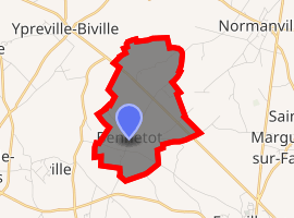
| |
 Bennetot  Bennetot | |
| Coordinates: 49°40′19″N 0°33′11″E | |
| Country | France |
| Region | Normandy |
| Department | Seine-Maritime |
| Arrondissement | Le Havre |
| Canton | Saint-Valery-en-Caux |
| Commune | Terres-de-Caux |
| Area 1 | 4.58 km2 (1.77 sq mi) |
| Population (2017)[1] | 181 |
| • Density | 40/km2 (100/sq mi) |
| Time zone | UTC+01:00 (CET) |
| • Summer (DST) | UTC+02:00 (CEST) |
| Postal code | 76640 |
| Elevation | 97–131 m (318–430 ft) (avg. 121 m or 397 ft) |
| 1 French Land Register data, which excludes lakes, ponds, glaciers > 1 km2 (0.386 sq mi or 247 acres) and river estuaries. | |
Geography
A small farming village situated in the Pays de Caux, some 22 miles (35 km) northeast of Le Havre, at the junction of the D926 and the D217.
Heraldry
Arms of Bennetot |
The arms of Bennetot are blazoned : Per bend sinister, 1: Or, an abbot's crozier gules, and to sinister a maltese cross sable; 2: vert, 2 leopards Or |
Population
| Year | 1962 | 1968 | 1975 | 1982 | 1990 | 1999 | 2006 |
|---|---|---|---|---|---|---|---|
| Population | 143 | 148 | 105 | 113 | 97 | 127 | 171 |
| From the year 1962 on: No double counting—residents of multiple communes (e.g. students and military personnel) are counted only once. | |||||||
Places of interest
- The church of St. André, dating from the seventeenth century.
- A sixteenth century manorhouse
Notable people
- Réné-Aubert Vertot, French historian, was born here on the 25th Nov 1655.
gollark: Well, yes.
gollark: Anyway, I'll have to sample some soul data to see if it is in fact broken somehow.
gollark: Hmm, it's down to 298MB somehow.
gollark: I have my data package somewhere, so just filter to public chat or something, and bees are your apiforms!
gollark: A gollarious neural network *would* have many practical applications.
References
- Téléchargement du fichier d'ensemble des populations légales en 2017, INSEE
- Arrêté préfectoral 12 September 2016 (in French)
| Wikimedia Commons has media related to Bennetot. |
| Authority control |
|
|---|
This article is issued from Wikipedia. The text is licensed under Creative Commons - Attribution - Sharealike. Additional terms may apply for the media files.