Bell Craig
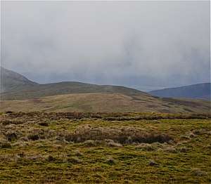
Bell Craig is a hill in the Ettrick Hills range, part of the Southern Uplands of Scotland. It is part of a ridge that runs parallel to the A708 road on its southern side, with White Coomb in the Moffat Hills directly opposite.[4] The northern slopes are designated as part of the 'Moffat Hills' SSSI and SAC - the summit marks a corner of the area.[5]
| Bell Craig | |
|---|---|
 | |
| Highest point | |
| Elevation | 623 m (2,044 ft) [1] |
| Prominence | 47 m (154 ft) [2] |
| Listing | Tu,Sim,D,GT,DN [3] |
| Geography | |
| Location | Dumfries and Galloway, Scottish Borders, Scotland |
| Parent range | Ettrick Hills, Southern Uplands |
| OS grid | NT 18655 12860 |
| Topo map | OS Landranger 79 |
Subsidiary SMC Summits
| Summit | Height (m) | Listing[6] |
|---|---|---|
| Mid Rig | 615.8 | Tu,Sim,DT,GT,DN[7] |
gollark: It is useful to be able to just upload from the interweb, though.
gollark: Okay. Not sure what the point of bringing it up here is.
gollark: As I said, just have multiple out of game servers using Node or whatever and have a Krist-y API for ingame computers to use.
gollark: Oh, Lua libraries.
gollark: There are good libraries available, so that doesn't sound very problematic.
References
- "Bell Craig". www.hill-bagging.co.uk.
- https://www.hill-bagging.co.uk/mountaindetails.php?qu=S&rf=1904
- http://www.hills-database.co.uk/database_notes.html#classification
- "New Donalds Map". www.mountainsofscotland.co.uk.
- "SiteLink". sitelink.nature.scot.
- http://www.hills-database.co.uk/database_notes.html#classification
- http://www.hill-bagging.co.uk/mountaindetails.php?qu=S&rf=1907
This article is issued from Wikipedia. The text is licensed under Creative Commons - Attribution - Sharealike. Additional terms may apply for the media files.