Batesville Regional Airport
Batesville Regional Airport (IATA: BVX, ICAO: KBVX, FAA LID: BVX) is a public-use airport located three nautical miles (4 mi, 6 km) south of the central business district of Batesville, in Independence County, Arkansas, United States. It is owned by the City of Batesville.[1]
Batesville Regional Airport | |||||||||||||||
|---|---|---|---|---|---|---|---|---|---|---|---|---|---|---|---|
 | |||||||||||||||
| Summary | |||||||||||||||
| Airport type | Public | ||||||||||||||
| Owner | City of Batesville | ||||||||||||||
| Serves | Batesville, Arkansas | ||||||||||||||
| Elevation AMSL | 465 ft / 142 m | ||||||||||||||
| Coordinates | 35°43′34″N 091°38′51″W | ||||||||||||||
| Website | BatesvilleRegionalAirport.com | ||||||||||||||
| Map | |||||||||||||||
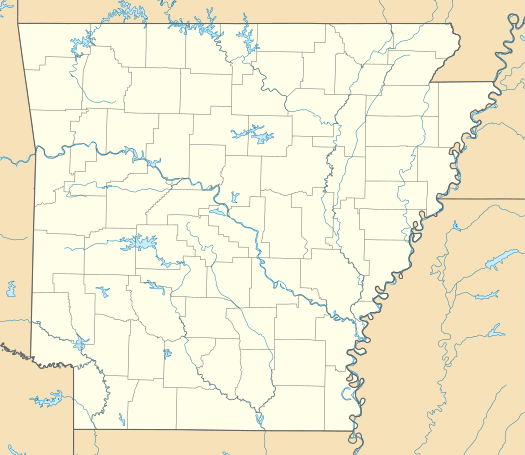 BVX Location of airport in Arkansas | |||||||||||||||
| Runways | |||||||||||||||
| |||||||||||||||
| Statistics (2008) | |||||||||||||||
| |||||||||||||||
This airport is included in the FAA's National Plan of Integrated Airport Systems for 2011–2015, which categorized it as a general aviation airport.[2]
Facilities and aircraft
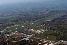
Batesville Regional Airport covers an area of 398 acres (161 ha) at an elevation of 465 feet (142 m) above mean sea level. It has two asphalt paved runways: 8/26 is 6,002 by 150 feet (1,829 x 46 m) and 18/36 is 2,804 by 60 feet (855 x 18 m).[1]
For the 12-month period ending May 31, 2008, the airport had 35,000 aircraft operations, an average of 95 per day: 86% general aviation, 9% air taxi, and 6% military. At that time there were 53 aircraft based at this airport: 77% single-engine, 21% multi-engine and 2% jet.[1]
References
- FAA Airport Master Record for BVX (Form 5010 PDF). Federal Aviation Administration. effective 25 August 2011.
- "2011–2015 NPIAS Report, Appendix A (PDF, 2.03 MB)" (PDF). 2011–2015 National Plan of Integrated Airport Systems. Federal Aviation Administration. 4 October 2010. Archived from the original (PDF) on 2012-09-27.
External links
- Batesville Regional Airport
- Batesville Regional (BVX) at Arkansas Department of Aeronautics
- Aerial image as of 28 February 2001 from USGS The National Map
- FAA Terminal Procedures for BVX, effective July 16, 2020
- Resources for this airport:
- FAA airport information for BVX
- AirNav airport information for KBVX
- ASN accident history for BVX
- FlightAware airport information and live flight tracker
- NOAA/NWS weather observations: current, past three days
- SkyVector aeronautical chart, Terminal Procedures