Batenburg
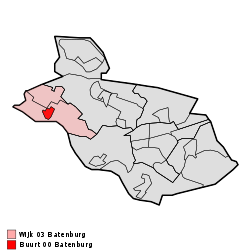
Batenburg is a village in the municipality of Wijchen, in the Dutch province of Gelderland. It is located on the Meuse, about 15 km west of Nijmegen. It is well known for the remains of a medieval fort in the center of the town. The town gained cityrights in the 14th century, although it only has a population of about 650 today
Batenburg | |
|---|---|
 | |
| Coordinates: 51°49′24″N 5°37′40″E | |
| Country | Netherlands |
| Province | Gelderland |
| Municipality | Wijchen |
| Population | ca. 600 |
Until 1984, Batenburg was a separate municipality.
Gallery
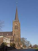 Church: de Sint Victorkerk
_op_de_achtergrond_foto7_2015-12-09_12.50.jpg) Sculpture (de Boombeelden) designed by Marc de Roover
Sculpture (de Boombeelden) designed by Marc de Roover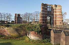
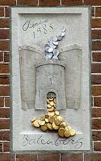 Batenburg gevelsteen, Prinsengracht, Amsterdam
gollark: So you can choose to buy water or not-water.
gollark: Like I said, I also support UBI or similar "free money" policies.
gollark: In theory you could get better efficiency out of dictatorial central planning, but it's a hard computational problem and has various practical issues beyond that.
gollark: I am personally fairly happy with exchanging money for goods and services.
gollark: Unlike for, say, mobile data plans, where the scarcity is completely artificial because the limited resource is bitrate and not total transfer. I'm not sure how that happened.
External links
- J. Kuyper, Gemeente Atlas van Nederland, 1865-1870, "Batenburg". Map of the former municipality, around 1868.
This article is issued from Wikipedia. The text is licensed under Creative Commons - Attribution - Sharealike. Additional terms may apply for the media files.