Barrier ridge
The terms barrier ridge,[1] a term of art[2] in the Earth Sciences, especially Geology and sometimes barrier range (more common as a geography term) describing the existence of gross landforms describing long ridgelines which are particularly difficult to pass, especially in the context of being on foot or dependent upon other forms of animal powered transportation systems, in mountainous and sometimes hilly terrains.

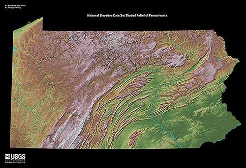
Barrier ridges such as the steep rising slopes or escarpments of the Allegheny Front, separating the ridge-and-valley Appalachians from the drainage divides of the uplands of the Appalachian Plateau. The ridge and valley region is filled with a succession of nearly impassible ridges from Southern Georgia, along the Appalachian chain all the way to Maine.
Notes
References
- "Example sentences with "barrier ridge"". English Dictionary online. English English Dictionary online. Retrieved 2016-05-07.
On the east side, the sand barrier ridge that separates the park's marshlands from the lake has been reduced to a slim ribbon of sand that occasionally is breached, exposing the marsh to the lake.
- Googlebooks reprint title, ed. (1894). publication: Collected Papers of Andrew Cowper Lawson, Volume I (1885-1894) • reprinted in State Geologist, Twentieth Annual Report, 1894. Paper: V. Sketch of the Coastal Topography of the North Side of LAKE SUPERIOR — With Special Reference to the Abandoned Strands of LAKE WARREN (The Greatest of the Late Quaternary Lakes of North America). p. 244, 251.
On a still lower delta plain and much nearer the lake is still another low barrier ridge which has an elevation of 103.5 feet (IX). The church of the village stands on...
External links
