Barmbek
Barmbek (![]()
Barmbek Barmbeck | |
|---|---|
Village | |
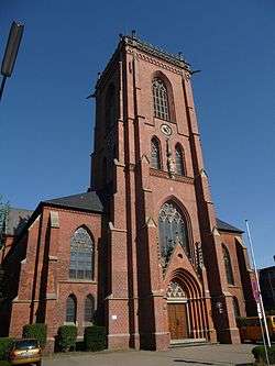 St. Sophia's Catholic Church built in 1900 | |
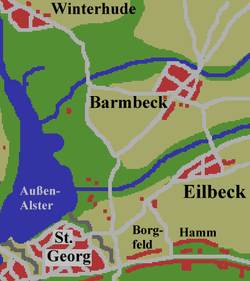 Map, situation in the north-east of Hamburg around 1800 | |
| Country | Germany |
| City | Hamburg |
History
It was first recorded in 1271 as "Bernebeke". Up until 1946 it was written with a 'c' as Barmbeck. Barmbeck and Barmbek are pronounced with a long e, similar to the English "Barm Bake". The village of Barmbeck had been under Hamburg administration since 1830, and it became a suburb of Hamburg in 1894,[1] while the area of Barmbek-Nord was incorporated into Hamburg in 1937 with the Greater Hamburg Act.[2]
Buildings
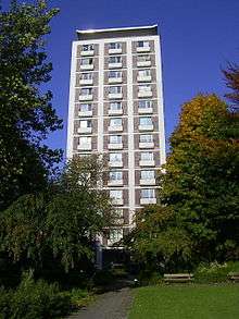
High-rise built in 1955
near Habichtstraße (Hamburg U-Bahn station)
- St. Sophia's Catholic Church
- Evangelical–Lutheran Bugenhagenkirche[3]
- AK Barmbek clinic
- AK Eilbek clinic[4]
- Museum of work
- Barmbek station[5]
gollark: Ah. Hmm. It is apparently now 152KB because dependencies or something, oh well.
gollark: My web application's only 110KB (minified, not gzipped)!
gollark: 18k ones are probably not that common.
gollark: On the plus side, you can use R U S T™ on the web now!
gollark: WASM blobs for things are often significantly bigger than JS for that thing.
References
- History of Barmbek, History Workshop Barmbek, in German
- Barmbek-Nord, Hamburg.de, in German
- http://www.schoen-kliniken.com/ptp/kkh/eil/
- http://www.e-architect.co.uk/hamburg/bahnhof_hamburg_barmbek.htm
External links
| Wikimedia Commons has media related to Barmbek. |
This article is issued from Wikipedia. The text is licensed under Creative Commons - Attribution - Sharealike. Additional terms may apply for the media files.