Baltiysk (air base)
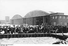
Baltiysk (also Noytif) was a military air base in Baltiysk, Kaliningrad Oblast, Russia. It is located on the Vistula Spit, 5 kilometers (3.1 mi) southwest of Baltiysk center within the city proper, on the opposite side of the Strait of Baltiysk close to the westernmost point of Russia.
Baltiysk | |||||||||||
|---|---|---|---|---|---|---|---|---|---|---|---|
| Summary | |||||||||||
| Airport type | Military | ||||||||||
| Operator | Soviet Air Force Luftwaffe | ||||||||||
| Location | Baltiysk, Kaliningrad Oblast, Russia | ||||||||||
| Elevation AMSL | 10 ft / 3 m | ||||||||||
| Coordinates | 54°36′36″N 019°52′6″E | ||||||||||
| Runways | |||||||||||
| |||||||||||

Originally constructed in the 1930s by Nazi Germany for the Luftwaffe, it was unused during World War II but was damaged by Allied bombings. In 1945 after the war ended, the air base came into possession of the Soviet Union and entered limited service with the Soviet Air Force, who used the remains of the air base to house a small number of interceptor alert pads.
In 1957 Western intelligence identified 25 Mig-15 (Fagot) jet fighters based at Baltiysk.[1] By the early 1960s, Baltiysk had become a reserve airfield, and intelligence missions no longer observed any aircraft the airfield.
The Baltiysk/Noytif Seaplane Base (54°37′25″N 19°52′45″E) operated in the harbor on the northeast side of the airfield until the 1970s.[2] It had five hangars adjoining the waters.[2] The Beriev Be-6 (Madge) was one type of seaplane observed at this base.[2]
The Baltiysk airfield complex was deactivated in the 1990s following the dissolution of the Soviet Union, and has since been abandoned.
References
- AIRFIELD ACTIVITY IN THE USSR AND SATELLITES (BASED ON(Sanitized)PHOTOGRAPHY), October 1957, CREST: CIA-RDP78T04753A000300040010-6, Central Intelligence Agency, Washington, DC.
- OAK SUPPLEMENT PART 7 KH-9 MISSION 1204 11 OCTOBER - 17 DECEMBER 1972, January 1973, CREST: CIA-RDP78T04752A000100010004-2, Central Intelligence Agency, Washington, DC., p. 125.