Balis Ridge
Balis Ridge (Bulgarian: рид Балис, ‘Rid Balis’ \'rid ba-'lis\ is the rocky, partly ice-covered ridge extending 7 km in southeast-northwest direction, 1.9 km wide and rising to 1100 m in the north foothills of Forbidden Plateau on Danco Coast in Graham Land, Antarctica. It surmounts Rozier Glacier to the northeast, Montgolfier Glacier to the southwest, and Wilhelmina Bay and its southwesterly part Piccard Cove to the northwest where the ridge ends in Sophie Cliff.
The ridge is named after the Thracian god Balis.
Location
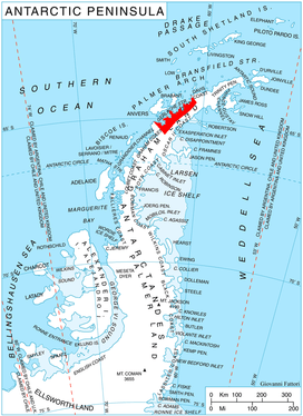
Balis Ridge is located at 64°46′43″S 62°08′39″W, which is 5.55 km east of Bacho Kiro Peak, 5.34 km south-southwest of Pishtachev Peak and 7.28 km northwest of Mount Walker. British mapping in 1980.
Maps
- British Antarctic Territory. Scale 1:200000 topographic map. DOS 610 Series, Sheet W 64 62. Directorate of Overseas Surveys, Tolworth, UK, 1980.
- Antarctic Digital Database (ADD). Scale 1:250000 topographic map of Antarctica. Scientific Committee on Antarctic Research (SCAR). Since 1993, regularly upgraded and updated.
References
- Bulgarian Antarctic Gazetteer. Antarctic Place-names Commission. (details in Bulgarian, basic data in English)
- Balis Ridge. SCAR Composite Gazetteer of Antarctica.
External links
- Balis Ridge. Copernix satellite image
This article includes information from the Antarctic Place-names Commission of Bulgaria which is used with permission.