Bajura Adentro
Bajura Adentro is a barrio in the municipality of Manatí, Puerto Rico. Its population in 2010 was 2,436.[3][4][5]
Bajura Adentro | |
|---|---|
Barrio | |
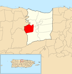 Location of Bajura Adentro within the municipality of Manatí shown in red | |
 Bajura Adentro Location of Puerto Rico | |
| Coordinates: 18°24′20″N 66°31′15″W[1] | |
| Commonwealth | |
| Municipality | |
| Area | |
| • Total | 3.98 sq mi (10.3 km2) |
| • Land | 3.98 sq mi (10.3 km2) |
| • Water | 0 sq mi (0 km2) |
| Elevation | 384 ft (117 m) |
| Population (2010) | |
| • Total | 2,436 |
| • Density | 612.1/sq mi (236.3/km2) |
| Source: 2010 Census | |
| Time zone | UTC−4 (AST) |
History
The United States took control of Puerto Rico from Spain in the aftermath of the Spanish-American War under the terms of the Treaty of Paris of 1898. In 1899, the United States conducted its first census of Puerto Rico finding that the population of Bajura Adentro barrio was 881.[6]
gollark: Consider? Yes. Probably actually do so? No.
gollark: I'm worrying that Minoteaur's code is too accursedly accursuous already.
gollark: Don't worry, you can't.
gollark: I definitely made *a* version.
gollark: That really was great artwork by me.
See also
References
- "US Gazetteer 2019". US Census. US Government.
- U.S. Geological Survey Geographic Names Information System: Bajura Adentro barrio
- Picó, Rafael; Buitrago de Santiago, Zayda; Berrios, Hector H. Nueva geografía de Puerto Rico: física, económica, y social, por Rafael Picó. Con la colaboración de Zayda Buitrago de Santiago y Héctor H. Berrios. San Juan Editorial Universitaria, Universidad de Puerto Rico,1969.
- Gwillim Law (20 May 2015). Administrative Subdivisions of Countries: A Comprehensive World Reference, 1900 through 1998. McFarland. p. 300. ISBN 978-1-4766-0447-3. Retrieved 25 December 2018.
- Puerto Rico:2010:population and housing unit counts.pdf (PDF). U.S. Dept. of Commerce, Economics and Statistics Administration, U.S. Census Bureau. 2010.
- Joseph Prentiss Sanger; Henry Gannett; Walter Francis Willcox (1900). Informe sobre el censo de Puerto Rico, 1899, United States. War Dept. Porto Rico Census Office (in Spanish). Imprenta del gobierno. p. 161.
This article is issued from Wikipedia. The text is licensed under Creative Commons - Attribution - Sharealike. Additional terms may apply for the media files.