Back Creek (Haw River tributary)
Back Creek is a 8.77 mi (14.11 km) long 4th order tributary to the Haw River, in Alamance County, North Carolina.
| Back Creek Tributary to Haw River | |
|---|---|
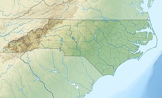
 Location of Back Creek mouth  Back Creek (Haw River tributary) (the United States) | |
| Location | |
| Country | United States |
| State | North Carolina |
| County | Alamance Orange |
| City | Graham |
| Physical characteristics | |
| Source | divide between Back Creek and Lynch Creek |
| • location | pond about 0.5 miles northeast of Carr, North Carolina |
| • coordinates | 36°07′31″N 079°18′02″W[1] |
| • elevation | 720 ft (220 m)[2] |
| Mouth | Haw River |
• location | about 1.5 miles southeast of Graham, North Carolina |
• coordinates | 36°02′44″N 079°22′04″W[1] |
• elevation | 476 ft (145 m)[1] |
| Length | 8.77 mi (14.11 km)[3] |
| Basin size | 81.21 square miles (210.3 km2)[4] |
| Discharge | |
| • location | Haw River |
| • average | 88.66 cu ft/s (2.511 m3/s) at mouth with Haw River[4] |
| Basin features | |
| Progression | southwest |
| River system | Haw River |
| Tributaries | |
| • left | Mill Creek |
| • right | Stagg Creek Quaker Creek |
| Waterbodies | Quaker Creek Reservoir |
Variant names
According to the Geographic Names Information System, it has also been known historically as:[1]
- Buffalo Creek
Course
Back Creek rises in a pond about 0.5 miles northeast of Carr in Orange County, North Carolina and then flows southwest to the Haw River about 1.5 miles southeast of Graham, North Carolina.[2]
Watershed
Back Creek drains 81.21 square miles (210.3 km2) of area, receives about 46.3 in/year of precipitation, and has a wetness index of 430.93 and is about 44% forested.[4]
gollark: *How* urgent?
gollark: Anyway, what I was saying is that maybe you can use the methods it claims only apply to Craftable things on whatever the getItemsInNetwork thing returns.
gollark: Maybe put in a fake recipe which says it uses some random item or other, detect that, and then run the crafting job.
gollark: You can probably work out some kind of horrible bodge for it.
gollark: Or at least request-able things.
References
- "GNIS Detail - Back Creek". geonames.usgs.gov. US Geological Survey. Retrieved 4 October 2019.
- "Back Creek Topo Map, Alamance County NC (Mebane Area)". TopoZone. Locality, LLC. Retrieved 4 October 2019.
- "ArcGIS Web Application". epa.maps.arcgis.com. US EPA. Retrieved 4 October 2019.
- "Back Creek Watershed Report". Waters Geoviewer. US EPA. Retrieved 4 October 2019.
This article is issued from Wikipedia. The text is licensed under Creative Commons - Attribution - Sharealike. Additional terms may apply for the media files.