Avenida Juan Ponce de León
Avenida Juan Ponce de León, coextensive as Route PR-25 along its entire length, is one of the main thoroughfares in San Juan, Puerto Rico.[3]
| ||||
|---|---|---|---|---|
| Avenida Juan Ponce de León | ||||
.png) | ||||
| Route information | ||||
| Maintained by Puerto Rico DTPW | ||||
| Length | 11.1 km[1][2] (6.9 mi) | |||
| Major junctions | ||||
| South end | ||||
| ||||
| North end | Calle Fortaleza / Calle Recinto Sur in San Juan Antiguo | |||
| Location | ||||
| Municipalities | San Juan | |||
| Highway system | ||||
| ||||

It is a mostly three-lane, one-way road. It runs from Old San Juan to Río Piedras pueblo[4] and, for most of its length, it is a three- or four-lane road traversing the Isleta de San Juan corridor. The section running through Río Piedras pueblo is the only section that is not a multi-lane roadway.
.jpg)
Urban landscape
Institutional, cultural and other notable buildings predominate along the thoroughfare and it is considered as one of the main arteries in shopping errands, community participation, cultural activities and of personnel training of the city,[5] it also constitutes an attraction for its architecture.[6]
A stretch of Avenida Ponce de León has been designated as the arts district.[7] It starts in Miramar and continues towards Hato Rey for 4 miles.
Major intersections
The entire route is located in San Juan.
| Location | km[1][2][8] | mi | Destinations | Notes | |||
|---|---|---|---|---|---|---|---|
| Monacillo Urbano | 0.0 | 0.0 | Southern terminus of PR-8838 | ||||
| 1.2 | 0.75 | Southern terminus of Avenida Juan Ponce de León | |||||
| 1.8 | 1.1 | Avenida José de Diego – Puerto Nuevo | |||||
| El Cinco | 2.7 | 1.7 | |||||
| 3.0 | 1.9 | ||||||
| 3.3 | 2.1 | Northern terminus of PR-8838 | |||||
| Gap in route | |||||||
| Pueblo–Hato Rey Sur line | 11.1 | 6.9 | Southern terminus of PR-25; PR-3 westbound exit and PR-1 northbound entrance | ||||
| Universidad–Hato Rey Sur line | 10.0– 9.9 | 6.2– 6.2 | Diamond interchange | ||||
| Hato Rey Central–Hato Rey Norte line | 8.1– 8.0 | 5.0– 5.0 | |||||
| 7.7 | 4.8 | One-way street; eastbound access via Calle Bolivia | |||||
| Caño Martín Peña | 7.0 | 4.3 | Puente Martín Peña[9] | ||||
| Santurce | 6.9– 6.8 | 4.3– 4.2 | |||||
| 6.5 | 4.0 | ||||||
| 5.7 | 3.5 | Avenida José Fidalgo Díaz – Santurce | |||||
| 5.2 | 3.2 | No turn to westbound | |||||
| 5.1– 5.0 | 3.2– 3.1 | PR-22 exit 0A | |||||
| 4.4– 4.3 | 2.7– 2.7 | ||||||
| 3.8 | 2.4 | One-way street | |||||
| 2.9 3.4[lower-alpha 1] | 1.8 2.1 | Southern terminus of PR-1 concurrency; northern terminus of Avenida Juan Ponce de León | |||||
| Caño de San Antonio | 3.2[lower-alpha 1] | 2.0 | Puente San Antonio and Puente Guillermo Esteves[9] | ||||
| San Juan Antiguo | 3.1[lower-alpha 1] 2.8 | 1.9 1.7 | Northern terminus of PR-1 concurrency; southern terminus of Avenida de la Constitución | ||||
| 1.0 | 0.62 | One-way street; westbound access via Calle Reverendo Gerardo Dávila | |||||
| 0.0 | 0.0 | Calle Fortaleza / Calle Recinto Sur – Old San Juan | Northern terminus of PR-25 and Avenida de la Constitución | ||||
1.000 mi = 1.609 km; 1.000 km = 0.621 mi
| |||||||
- Kilometer markers represent the distance along PR-1 rather than PR-25.
Gallery
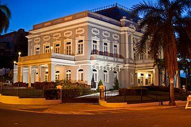 Casino de Puerto Rico,
1 Avenida Juan Ponce de León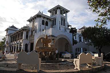 Casa de España, Puerta de Tierra
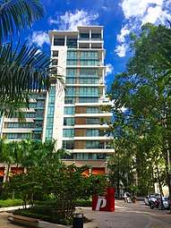 Ciudadela in Santurce
.jpg) Golden Mile en Hato Rey
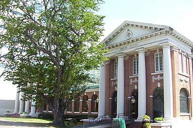
Golden Mile en Hato Rey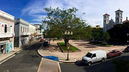 Plaza de la Convalecencia in Río Piedras Pueblo
References
- Google (28 February 2020). "PR-25 north" (Map). Google Maps. Google. Retrieved 28 February 2020.
- Google (28 February 2020). "PR-25 south" (Map). Google Maps. Google. Retrieved 28 February 2020.
- Puerto Rico (fold out) (Map). National Geographic Adventure Map (Book 3107). 7 May 2011. ISBN 978-1566955188.
- Puerto Rico Department of Transportation and Public Works. "Datos de Transito 2000-2009" (in Spanish). Retrieved 1 April 2019.
- Edwin R. Quiles Rodríguez. "La Ponce de León como metáfora". 80grados (in Spanish). Retrieved 27 February 2020.
- www.prfrogui.com History of the Roads of Puerto Rico-(in Spanish)-Retrieved 18 May 2018.
- Avenida de las Artes. "San Juan's Arts & Culture District". Retrieved 27 February 2020.
- Google (28 February 2020). "PR-8838" (Map). Google Maps. Google. Retrieved 28 February 2020.
- Luis F. Pumarada O’Neill (1991). "Los Puentes Históricos de Puerto Rico" (PDF) (in Spanish). Retrieved 10 March 2020.
External links
| Wikimedia Commons has media related to |
- Anuncia convocatoria de arte urbano en Avenida Ponce de León
- CBA de Santurce hace realidad el Pórtico de las Artes