Avawatz Mountains
The Avawatz Mountains are located in San Bernardino County, California, in the Mojave Desert.
| Avawatz Mountains | |
|---|---|
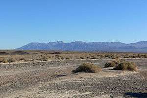 Seen from the north, in Death Valley | |
| Highest point | |
| Elevation | 1,872.7 m (6,144 ft) |
| Geography | |
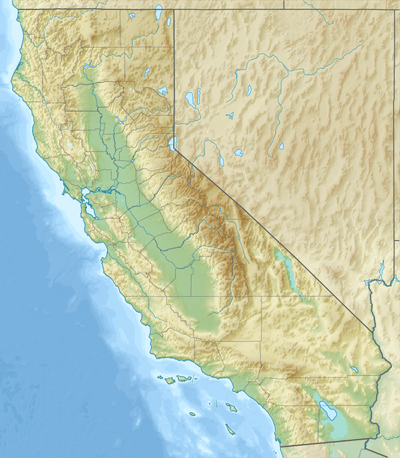 Location of the Avawatz Mountains in California [1] | |
| Country | United States |
| State | California |
| District | San Bernardino County |
| Range coordinates | 35°30′25″N 116°17′05″W |
| Topo map | USGS Sheep Creek Spring |
Name
The name "Avawatz" is derived from the Mohave Indian term "Avi-Ahwat", or "red rock".[2] An alternative theory holds that the name comes from the Southern Paiute word iva-wätz, meaning "white mountain sheep."[3]
Geography
The range lies to the west of State Route 127; between the Owlshead Mountains in the southern end of Death Valley National Park, and the Soda Mountains near the town of Baker.
Part of the Avawatz Mountain range lies in the National Training Center, which is part of the Fort Irwin Military Reservation, and is closed to the public.
The Avawatz Mountains reach an elevation of 1,872.7 meters (6,144 ft).
gollark: No.
gollark: And I can't rely on it existing for purposes.
gollark: For example, I cannot set up wildcard subdomains!
gollark: The fact is, having a bad free domain is reducing *many* opportunities for osmarks.tk development.
gollark: Anyway, I meant that I disliked it with a *value* of 22%, silly.
References
- U.S. Geological Survey Geographic Names Information System: Avawatz Mountains
- Vredenburgh, Larry M., 1988, Geology and mineral resources of the Avawatz Mountains Resource Area in Jennifer L. Gregory and E. Joan Baldwin, Geology of the Death Valley Region, Annual field trip guide book Number 16 (Santa Ana: South Coast Geological Society) p. 304 - 344.
- California Place Names: The Origin and Etymology of Current Geographical Names. University of California Press. 1960. p. 17. GGKEY:403N5Z6QERG. Retrieved 4 September 2016.
- California Road and Recreation Atlas, 2005, pg 96
This article is issued from Wikipedia. The text is licensed under Creative Commons - Attribution - Sharealike. Additional terms may apply for the media files.