Athavanad Grama Panchayat
Athavanad is a village in the Malappuram District of the Indian state of Kerala.[1]
Athavanad Grama Panchayat | |
|---|---|
Grama Panchayat | |
 Puthanathani, Athavanad | |
 Athavanad Grama Panchayat Location in Kerala, India  Athavanad Grama Panchayat Athavanad Grama Panchayat (India) | |
| Coordinates: 10.905870°N 76.0251400°E | |
| Country | |
| State | Kerala |
| District | Malappuram |
| Population (2011) | |
| • Total | 41,187 |
| PIN | 676552 |
Geography
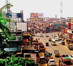
Puthanathani is the main town there, sited on National Highway 17 between Kottakkal and Valanchery. Roads to Vailathur (and hence Tirur) and Thirunavaya run through Puthanathani. Many people from Puthanathani and surrounding areas work overseas, mostly in Persian Gulf countries.[2]
History
In ancient times, the region was under the feudal lords Azhvanchery Thamprakkal. In Malayalam, "Athavanad" is the abbreviation of "Azhvanchery Thambrakkal Vazhunna Nadu". The Zamorin of Calicut also controlled the area.
Demographics
As of 2011in the India census, Athavanad had a population of 41187, with 19298 males and 21889females.[1]
Culture
Athavanad village is predominantly a Muslim area. Hindus exist in comparatively smaller numbers. People gather in mosques for prayers and remain after prayers to discuss social and cultural issues.
Business and family issues are also sorted out during evening meetings. The Hindu minority of this area keeps their rich traditions by celebrating various festivals in their temples. In Athavanad, Hindu rituals are done with a regular devotion, as in other parts of Kerala.[3]
Transport
Athavanad village connects to other parts of India through the town of Kottakkal. National highway No.66 passes through Tanur and the northern stretch connects to Goa and Mumbai. The southern stretch connects to Cochin and Trivandrum.
State Highway No.28 starts from Nilambur and connects to Ooty, Mysore and Bangalore through Highways.12,29 and 181. National Highway No.966 connects to Palakkad and Coimbatore. The nearest airport is at Kozhikode. The nearest major railway station is at Tirur.
Education
The Village has several educational institutions, from the school level to higher education. Institutions include:
- Athavanad Parithi High school
- Athavanad Mattummal Higher Secondary School
- Markazu Tharbiyathul Islam Higher Secondary School
- Markaz Residential School
- Markazu Tharbiyathul Teachers Training Center
- Markazu Tharbiyathul Islam
- Hifz college
- Markazu Tharbiyathul Islam B-Ed
- Badariyya Arabic college Palathani
- PMSA orphanage hospital athavanad kattilangadi
- Markaz Arts And Science College
- Karthala
- Athavanadu
- KMCT Polytechnic College
- KMCT Law College
- Z.M.H.S Poolamangalam
- Majmau Orphanage
- Mohammed Ali Shihab Thangal Memorial Arts And Science College
- Majmau Higher Secondary School
- Majmau Thazkiyath Islamiya
See also
References
- Registrar General & Census Commissioner, India. "Census of India : Villages with population 5000 & above". Archived from the original on 8 December 2008. Retrieved 10 December 2008.
- "ആതവനാട് ഗ്രാമപഞ്ചായത്ത് (Athavanad Grama Panchayat)". lsgkerala.in. Retrieved 12 May 2018.
- "Archived copy". Archived from the original on 1 April 2016. Retrieved 14 July 2016.CS1 maint: archived copy as title (link)
- "dchb malappuram" (PDF). censusindia.gov.in.