Aravis Range
The Aravis (French: Chaîne des Aravis) is a mountain range in Savoie and Haute-Savoie, eastern France. It is part of the French Prealps, a lower chain of mountain ranges west of the main chain of the Alps. Its highest summit is the Pointe Percée, at 2753m. The orientation of the Aravis is north-south, and it stretches from Cluses in the north, to Ugine in the south. The Bornes massif, sometimes considered part of the Aravis, lies to its west. The Aravis is separated from the Chablais mountains in the north-east by the Arve river valley, and from the Graian Alps in the south-east by the Arly river valley.
| Aravis Range | |
|---|---|
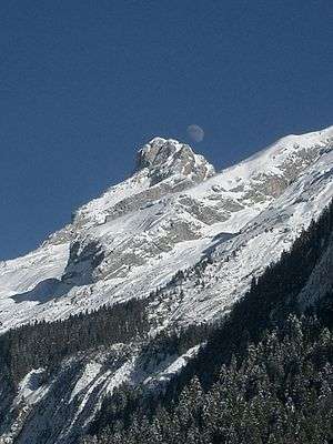 Pointe Percée | |
| Highest point | |
| Peak | Pointe Percée |
| Elevation | 2,753 m (9,032 ft) |
| Coordinates | 45°57′21″N 6°33′20″E |
| Naming | |
| Native name | French: Chaîne des Aravis |
| Geography | |
| Country | France |
| Department | Savoie and Haute-Savoie |
| Parent range | French Prealps |
| Borders on | Chablais and Graian Alps |
| Geology | |
| Type of rock | Sedimentary |
Peaks
- Pointe Percée, 2,753 m (9,032 ft)
- Grande Balmaz, 2,616 m (8,583 ft)
- Roualle, 2,589 m (8,494 ft)
- Parrossaz, 2,556 m (8,386 ft)
- Mont Charvet, 2,538 m (8,327 ft)
- Roche Perfia, 2,499 m (8,199 ft)
- Aiguille de Borderan, 2,489 m (8,166 ft)
- Étale (mountain), 2,484 m (8,150 ft)
- Pointe d'Areu, 2,478 m (8,130 ft)
- Mont Charvin, 2,409 m (7,904 ft)
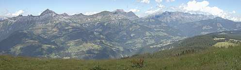
Panorama
gollark: I have said repeatedly: I have a case.
gollark: Dropping it front down, sure? Though some cases and stuff would prevent that.
gollark: I can't magically just not drop things. I want a phone which is robust enough to actually handle my use instead of forcing me to try and adapt my behavior.
gollark: I actually like what Windows Phones were like. Apart from the whole Windows thing. Shame they cancelled those.
gollark: Well, to some extent, but that's not an excuse for terrible phones.
This article is issued from Wikipedia. The text is licensed under Creative Commons - Attribution - Sharealike. Additional terms may apply for the media files.