Apiaria Bight
Apiaria Bight (Bulgarian: залив Апиария, ‘Zaliv Apiaria’ \'za-liv a-pi-'a-ri-ya\) is the 5.7 km wide embayment indenting for 1.7 km the northwest coast of Pasteur Peninsula on Brabant Island in the Palmer Archipelago, Antarctica. It is entered northeast of Metchnikoff Point and southwest of Cape Roux, and has Soatris Island lying near the southwest side of its entrance.
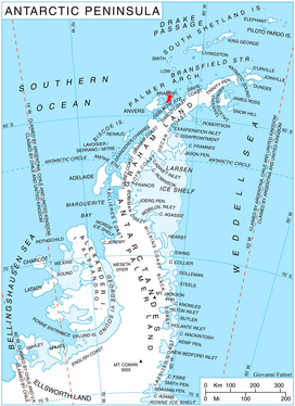
Location of Brabant Island in the Antarctic Peninsula region.
Eponymy
The bight is named after the ancient Roman fortified city and Byzantine bishopric of Apiaria (Appiaria) in Moesia Inferior, now in Northeastern Bulgaria.
Maps
- Antarctic Digital Database (ADD). Scale 1:250000 topographic map of Antarctica. Scientific Committee on Antarctic Research (SCAR). Since 1993, regularly upgraded and updated.
- British Antarctic Territory. Scale 1:200000 topographic map. DOS 610 Series, Sheet W 64 62. Directorate of Overseas Surveys, Tolworth, UK, 1980.
- Brabant Island to Argentine Islands. Scale 1:250000 topographic map. British Antarctic Survey, 2008.
Sources
- Bulgarian Antarctic Gazetteer. Antarctic Place-names Commission. (details in Bulgarian, basic data in English)
- Apiaria Bight. SCAR Composite Antarctic Gazetteer.
gollark: Oh, we're doing bee eugenics.
gollark: Maths stuff is objectively-true-given-some-axioms.
gollark: Personally, I completely support forced (subsidized) genetic engineering on children, once the technology matures.
gollark: r-strategy versus k-strategy or something maybe.
gollark: Well, you don't control people's preferences and actually it seems to work the other way round.
External links
- Apiaria Bight. Copernix satellite image

Brabant Island from northeast, with Anvers Island (on the right) and Antarctic Peninsula in the background; Pasteur Peninsula is seen as the nearest part of the island on the right.
This article includes information from the Antarctic Place-names Commission of Bulgaria which is used with permission.
This article is issued from Wikipedia. The text is licensed under Creative Commons - Attribution - Sharealike. Additional terms may apply for the media files.