Aorangaia Island
Aorangaia Island is an island in the Northland Region of New Zealand,[1] part of the Poor Knights Islands. It has a highest point of 102 metres (335 ft) and is 21 kilometres (13 mi) from the New Zealand mainland.
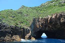
 Rock tunnel in Aorangaia Island | |
| Geography | |
|---|---|
| Location | Northland Region |
| Coordinates | 35.4862°S 174.7466°E |
| Highest elevation | 102 m (335 ft) |
| Administration | |
| Demographics | |
| Population | 0 |
See also
- List of islands of New Zealand
- List of islands
- Desert island
References
- "Place name detail: Aorangaia Island". New Zealand Gazetteer. Land Information New Zealand. Retrieved 27 March 2009.
This article is issued from Wikipedia. The text is licensed under Creative Commons - Attribution - Sharealike. Additional terms may apply for the media files.