Anones
Anones is a barrio in the municipality of Naranjito, Puerto Rico. Its population in 2010 was 4,976.[3][4][5] Anones is located to the South of the urban center of the municipality. There are schools and shops here and it is the most mountainous area of the municipality.[6]
Anones | |
|---|---|
Barrio | |
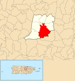 Location of Anones within the municipality of Naranjito shown in red | |
 Anones Location of Puerto Rico | |
| Coordinates: 18°16′22″N 66°14′50″W[1] | |
| Commonwealth | |
| Municipality | |
| Government | |
| • Mayor | Orlando Ortiz Chevres |
| Area | |
| • Total | 5.94 sq mi (15.4 km2) |
| • Land | 5.94 sq mi (15.4 km2) |
| • Water | 0 sq mi (0 km2) |
| Elevation | 1,634 ft (498 m) |
| Population (2010) | |
| • Total | 4,976 |
| • Density | 837.7/sq mi (323.4/km2) |
| Source: 2010 Census | |
| Time zone | UTC−4 (AST) |
| Zip code | 00719 |
History
The United States took control of Puerto Rico from Spain in the aftermath of the Spanish-American War under the terms of the Treaty of Paris of 1898. In 1899, the United States conducted its first census of Puerto Rico finding that the population of Anones barrio was 1,420.[7]
Sectors
Barrios (which are like minor civil divisions)[8] in turn are further subdivided into smaller local populated place areas/units called sectores (sectors in English). The types of sectores may vary, from normally sector to urbanización to reparto to barriada to residencial, among others.[9][10][11]
The following sectors are in Anones barrio:[6][12]
Anones Díaz, Anones Don Tito, Carretera 152, Camino Manolín González, Comunidad Las Lágrimas, Comunidad Rogelio Ferrer, La Maya, La Sierra, Los Matos, Sector Álvaro Rodríguez, Sector Beltrán, Sector Cátala, Sector Cayito Ríos, Sector Cuatro Puertas, Sector El Cerro, Sector El Palmar, Sector El Pollito, Sector Flor Maure, Sector Fuentes, Sector Hernández, Sector Juan Sostre Coreano, Sector Los Vasallos, Sector Marcano, Sector Merce Alicea, Sector Mirador, Sector Molina, Sector Palin Cátala, Sector Pablo Cátala, Sector Punto Fijo, Rodríguez, Tito Cátala, and Villa Polilla.
References
- "US Gazetteer 2019". US Census. US Government.
- U.S. Geological Survey Geographic Names Information System: Anones barrio
- Picó, Rafael; Buitrago de Santiago, Zayda; Berrios, Hector H. Nueva geografía de Puerto Rico: física, económica, y social, por Rafael Picó. Con la colaboración de Zayda Buitrago de Santiago y Héctor H. Berrios. San Juan Editorial Universitaria, Universidad de Puerto Rico,1969.
- Gwillim Law (20 May 2015). Administrative Subdivisions of Countries: A Comprehensive World Reference, 1900 through 1998. McFarland. p. 300. ISBN 978-1-4766-0447-3. Retrieved 25 December 2018.
- Puerto Rico:2010:population and housing unit counts.pdf (PDF). U.S. Dept. of Commerce, Economics and Statistics Administration, U.S. Census Bureau. 2010.
- "Plan Territorial (2012)" (PDF). JP PR Gov (in Spanish). Gobierno Municipal de Naranjito -Oficina de Planificación y Ordenación Territorial. p. 43. Retrieved 26 June 2019.
- Joseph Prentiss Sanger; Henry Gannett; Walter Francis Willcox (1900). Informe sobre el censo de Puerto Rico, 1899, United States. War Dept. Porto Rico Census Office (in Spanish). Imprenta del gobierno. p. 162.
- "US Census Barrio-Pueblo definition". factfinder.com. US Census. Archived from the original on 13 May 2017. Retrieved 5 January 2019.
- "Agencia: Oficina del Coordinador General para el Financiamiento Socioeconómico y la Autogestión (Proposed 2016 Budget)". Puerto Rico Budgets (in Spanish). Retrieved 28 June 2019.
- Rivera Quintero, Marcia (2014), El vuelo de la esperanza: Proyecto de las Comunidades Especiales Puerto Rico, 1997-2004 (first ed.), San Juan, Puerto Rico Fundación Sila M. Calderón, ISBN 978-0-9820806-1-0
- "Leyes del 2001". Lex Juris Puerto Rico (in Spanish). Retrieved 24 June 2020.
- "PRECINTO ELECTORAL NARANJITO 073" (PDF). Comisión Estatal de Elecciones (in Spanish). PR Government. 26 September 2019. Retrieved 21 July 2020.