Aner Dam
Aner Dam, is an earthfill dam on Aner river in Shirpur taluka, Dhule district in state of Maharashtra in India. The dam is 8 km from Hisale villag which is situated near Shirpur-Chopda state highway in Shirpur Tehsil.
| Aner Dam | |
|---|---|
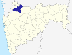
 Location of Aner Dam in Maharashtra | |
| Official name | Aner Dam |
| Location | Shirpur |
| Coordinates | 21.3250174°N 75.1442957°E |
| Opening date | 1978 |
| Owner(s) | Government of Maharashtra, India |
| Dam and spillways | |
| Type of dam | Earthfill |
| Impounds | Aner river |
| Height | 47 m (154 ft) |
| Length | 2,275 m (7,464 ft) |
| Dam volume | 3,162 km3 (759 cu mi) |
| Reservoir | |
| Total capacity | 58,914 km3 (14,134 cu mi) |
| Surface area | 0 km2 (0 sq mi) |
Specifications
The height of the dam above lowest foundation is 47 m (154 ft) while the length is 2,275 m (7,464 ft). The volume content is 3,162 km3 (759 cu mi) and gross storage capacity is 103,270.00 km3 (24,775.79 cu mi).[1]
Purpose
- Irrigation
gollark: Yes, horse.
gollark: ```Redeem this coupon at participating GTech™ apionic sites for six (4) nonillion apioform!Expires at the death of the universe, when time ceases to meaningfully exist, or after a Λ-8 event.Some conditions apply. Including the PotatOS privacy policy. But probably other ones, maybe.untrusted comment: signature from minisign secret keyRWTh5FGDfmGcoLPYxmVdSbaNfB2UXE34Ll4ilG8bSmEo4+qhnCbK935pYm/s+kYfA5ndIdrLAx8NztrPK/82aPSDhKD7NuCYbgQ=trusted comment: GTech™ couponic coupon of some sortTK4OWRgtRSYprYKgZYvwnK9uZfQBgKKEe0FNsZCXxkP7gbvqwJdqomCw+VllTDi2GjUuwuWFZ39tgpALTtqsCw==```
gollark: Oh, do you want a coupon for some apioforms, jabu?
gollark: Except you can actually save content from that.
gollark: Imagine papering paper.
See also
- Dams in Maharashtra
- List of reservoirs and dams in India
References
- Specifications of large dams in India Archived 21 July 2011 at the Wayback Machine
Dhule district topics | ||
|---|---|---|
| History |
|  |
| Rivers and lakes | ||
| Cities and towns | ||
| Culture |
| |
| Transport | ||
| Lok Sabha constituencies | ||
| Vidhan Sabha constituencies |
| |
This article is issued from Wikipedia. The text is licensed under Creative Commons - Attribution - Sharealike. Additional terms may apply for the media files.