Andrewhinney Hill
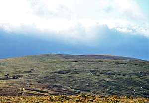
Andrewhinney Hill is a hill in the Ettrick Hills range, part of the Southern Uplands of Scotland. It is the highest summit of a ridge that runs parallel to the A708 road on its southern side, with the Grey Mare's Tail in the Moffat Hills directly opposite.[4] The northwestern slopes are designated as part of the 'Moffat Hills' SSSI and SAC.[5]
| Andrewhinney Hill | |
|---|---|
 | |
| Highest point | |
| Elevation | 677.3 m (2,222 ft) [1] |
| Prominence | 194 m (636 ft) [2] |
| Listing | Ma,Hu,Tu,Sim,G,D,DN,Y [3] |
| Geography | |
| Location | Dumfries and Galloway, Scottish Borders, Scotland |
| Parent range | Ettrick Hills, Southern Uplands |
| OS grid | NT 19760 13873 |
| Topo map | OS Landranger 79 |
Subsidiary SMC Summits
| Summit | Height (m) | Listing[6] |
|---|---|---|
| Trowgrain Middle | 728 | DT,sSim[7] |
gollark: They have slow refreshes.
gollark: E-ink might be kind of annoying if you want to have it display seconds.
gollark: Assuming "actual photo" means what I think it means they already have a screen chosen in that prototype.
gollark: And probably other ones.
gollark: Right, the Nokia N900 or whatever.
References
- http://www.hill-bagging.co.uk/mountaindetails.php?qu=S&rf=1876
- http://www.hill-bagging.co.uk/mountaindetails.php?qu=S&rf=1876
- http://www.hills-database.co.uk/database_notes.html#classification
- http://www.hill-bagging.co.uk/mountaindetails.php?qu=S&rf=1876
- https://sitelink.nature.scot/map
- http://www.hills-database.co.uk/database_notes.html#classification
- http://www.hill-bagging.co.uk/mountaindetails.php?rf=1900
This article is issued from Wikipedia. The text is licensed under Creative Commons - Attribution - Sharealike. Additional terms may apply for the media files.