Andard
Andard is a former commune in the Maine-et-Loire department in western France. On 1 January 2016, it was merged into the new commune of Loire-Authion.[2]
Andard | |
|---|---|
Part of Loire-Authion | |
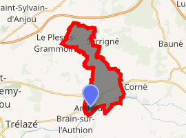
Location of Andard 
| |
 Andard  Andard | |
| Coordinates: 47°27′27″N 0°23′45″W | |
| Country | France |
| Region | Pays de la Loire |
| Department | Maine-et-Loire |
| Arrondissement | Angers |
| Canton | Angers-7 |
| Commune | Loire-Authion |
| Area 1 | 11.99 km2 (4.63 sq mi) |
| Population (2017)[1] | 2,468 |
| • Density | 210/km2 (530/sq mi) |
| Time zone | UTC+01:00 (CET) |
| • Summer (DST) | UTC+02:00 (CEST) |
| Postal code | 49800 |
| Elevation | 16–38 m (52–125 ft) (avg. 24 m or 79 ft) |
| 1 French Land Register data, which excludes lakes, ponds, glaciers > 1 km2 (0.386 sq mi or 247 acres) and river estuaries. | |
Population
| Year | Pop. | ±% |
|---|---|---|
| 1793 | 1,150 | — |
| 1800 | 1,084 | −5.7% |
| 1806 | 1,139 | +5.1% |
| 1821 | 1,153 | +1.2% |
| 1831 | 1,123 | −2.6% |
| 1836 | 1,168 | +4.0% |
| 1841 | 1,127 | −3.5% |
| 1846 | 1,122 | −0.4% |
| 1851 | 1,106 | −1.4% |
| 1856 | 1,140 | +3.1% |
| 1861 | 1,105 | −3.1% |
| 1866 | 1,066 | −3.5% |
| 1872 | 1,068 | +0.2% |
| 1876 | 1,049 | −1.8% |
| 1881 | 1,012 | −3.5% |
| 1886 | 993 | −1.9% |
| 1891 | 968 | −2.5% |
| 1896 | 1,006 | +3.9% |
| 1901 | 967 | −3.9% |
| 1906 | 940 | −2.8% |
| 1911 | 889 | −5.4% |
| 1921 | 822 | −7.5% |
| 1926 | 842 | +2.4% |
| 1931 | 839 | −0.4% |
| 1936 | 848 | +1.1% |
| 1946 | 924 | +9.0% |
| 1954 | 953 | +3.1% |
| 1962 | 1,016 | +6.6% |
| 1968 | 1,024 | +0.8% |
| 1975 | 1,261 | +23.1% |
| 1982 | 1,758 | +39.4% |
| 1990 | 2,085 | +18.6% |
| 1999 | 2,188 | +4.9% |
| 2006 | 2,414 | +10.3% |
| 2009 | 2,491 | +3.2% |
| 2012 | 2,501 | +0.4% |
gollark: Once I made a Rust program!
gollark: I use other things too!
gollark: PARADOX!
gollark: So now we agree on you disagreeing with me.
gollark: <@!309787486278909952> I must also disagree with gollark.
References
- Téléchargement du fichier d'ensemble des populations légales en 2017, INSEE
- Arrêté préfectoral Archived 2015-12-08 at the Wayback Machine 7 December 2015
This article is issued from Wikipedia. The text is licensed under Creative Commons - Attribution - Sharealike. Additional terms may apply for the media files.