Altenau, Lower Saxony
Altenau ([ˈʔaltənaʊ] (![]()
Altenau | |
|---|---|
Stadtteil of Clausthal-Zellerfeld | |
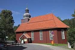 Saint Nicholas Church | |
 Coat of arms | |
Location of Altenau 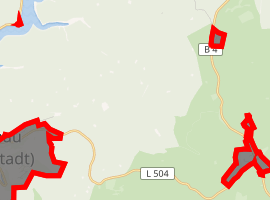
| |
 Altenau 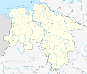 Altenau | |
| Coordinates: 51°48′10″N 10°26′44″E | |
| Country | Germany |
| State | Lower Saxony |
| District | Goslar |
| Town | Clausthal-Zellerfeld |
| Subdivisions | 2 districts |
| Area | |
| • Total | 4.66 km2 (1.80 sq mi) |
| Elevation | 460 m (1,510 ft) |
| Population (2018) | |
| • Total | 1,758 |
| • Density | 380/km2 (980/sq mi) |
| Time zone | CET/CEST (UTC+1/+2) |
| Postal codes | 38707 |
| Dialling codes | 05328 |
| Vehicle registration | GS |
| Website | www.altenau.info |
It is situated in the middle of the Harz mountains, between Clausthal-Zellerfeld and the Brocken. It was part of the former Samtgemeinde ("collective municipality") Oberharz.
Geography
Districts
- Altenau
- Torfhaus
History
Demographics
|
|
|
|
Sights
Politics
Town council
2006 local elections:
- SPD: 7 seats (54.16%)
- CDU: 6 seats (45.84%)
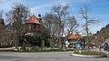 Town center
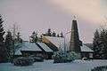 Saint Oliver Church
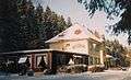 Former railway station
 Side building, former railway station
gollark: ++rust
gollark: ++rust
gollark: Rust compiles *so* fast! This 150-line program only took 53 seconds to build in release mode!
gollark: <@319753218592866315> Rename it to rust-discussion please.
gollark: Rust.Rust.Rust.Rust.
References
- Josef Walz: Der Harz, p.83. Köln 1995
- Evert Heusinkveld: Die Innerstetalbahn Langelsheim - Altenau, p.89. Nordhorn 2007
External links
| Wikimedia Commons has media related to Altenau. |
- Samtgemeinde Oberharz (in German)
- Altenau at Curlie
| Authority control |
|
|---|
This article is issued from Wikipedia. The text is licensed under Creative Commons - Attribution - Sharealike. Additional terms may apply for the media files.